
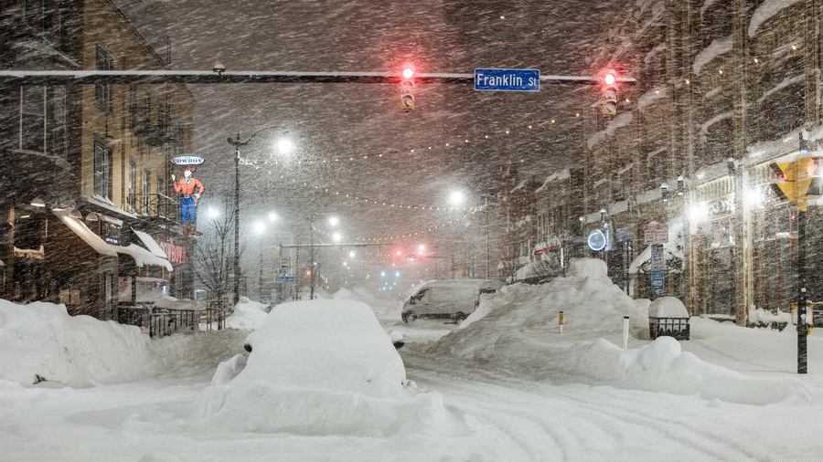
Buffalo is under the grip of an Arctic blast, with wind chills plunging as low as -20°F (-29°C) and snow adding to the winter woes. The National Weather Service warns of dangerous cold conditions through Thursday, as well as snowfall expected to impact the evening commute.
What’s in the Forecast?
- Wednesday: Bitterly cold with mostly cloudy skies. Highs will reach only 14°F (-10°C), and wind chills will make it feel much colder. Snow accumulations of 2 to 4 inches are expected later in the evening.
- Thursday: Slightly warmer, with highs near 26°F (-4°C). Light snow and flurries will continue, but extreme wind chills in the early morning hours remain a concern.
What to Watch Out For
The combination of bitter cold and wind poses a significant risk of frostbite and hypothermia for those spending extended periods outdoors. Snowfall may lead to slippery road conditions, making travel hazardous during the evening and early morning commutes.
How to Stay Safe:
- Limit Time Outside: If you must go out, wear multiple layers, gloves, and a hat to protect against frostbite.
- Prepare Your Vehicle: Keep a winter emergency kit in your car and drive cautiously on snow-covered roads.
- Check on Vulnerable Individuals: Ensure elderly neighbors and those with limited heating have the resources they need.
Looking Ahead:
While conditions may improve slightly after Thursday, temperatures will remain below freezing for the rest of the week. Light snow flurries are expected to persist, so continued caution is advised.
Conclusion:
Buffalo’s extreme cold is no small matter. With wind chills near -20°F and snow complicating travel, residents are urged to stay safe and prepared. Whether you’re braving the outdoors or staying indoors, take precautions to protect yourself and your loved ones during this Arctic blast.