
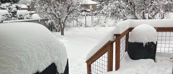
Utah is gearing up for a heavy snowstorm this weekend, with snowfall totals expected to reach up to 12 inches in some areas by late Saturday night. This winter system will bring widespread snow, creating hazardous travel conditions and impacting mountain passes and urban areas alike.
Snowfall began early Saturday and will intensify throughout the day, affecting regions along the Wasatch Front and the surrounding valleys. Mountain areas, including ski resorts, are forecasted to receive the heaviest accumulations, while valley areas could see 6-8 inches. Winds will gust up to 20-30 mph, causing blowing snow and reduced visibility on roads.
Travelers should expect slick and icy road conditions, particularly on major highways and mountain passes such as I-80 and Parley’s Canyon. Officials recommend avoiding non-essential travel and carrying winter emergency kits if venturing out.
The snowstorm is part of an active weather pattern that has brought multiple storms to Utah in recent weeks. Temperatures will remain cold, with daytime highs in the 20s and 30s, and lows dropping into the teens overnight.
Snow is expected to taper off late Saturday night, but lingering flurries and icy conditions could persist into Sunday morning, making road cleanup and commutes potentially difficult.
CONCLUSION:
With up to a foot of snow on the way, Utah residents should prepare for a challenging but beautiful winter weekend. Stay safe, plan ahead, and enjoy the snow responsibly—whether it’s on the slopes or from the warmth of your home.