
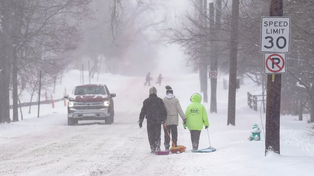
It’s time to break out the heavy coats and ice scrapers, Indiana—winter isn’t done with us yet. A powerful midweek storm is heading our way, bringing a nasty mix of freezing rain, sleet, and snow that could turn our roads into skating rinks and disrupt travel plans. If you’ve got places to be on Wednesday, consider rethinking those plans or at least prepare for a tricky commute.
Indianapolis: Freezing Rain Could Turn Roads Dangerous
If you’re in Indianapolis, today isn’t too bad. We’re seeing cloudy skies and a chilly 35°F (2°C) with a high of 42°F (6°C). But don’t get too comfortable because things take a turn on Wednesday. Rain will start in the afternoon, and as temperatures hover near freezing, it could quickly become freezing rain by the evening. Expect slippery roads and sidewalks, especially during the late afternoon and evening commute. Even a small amount of ice can be dangerous, so give yourself extra time if you have to drive. Highs on Wednesday will hit 38°F (4°C), with overnight temperatures around 35°F (2°C).
Fort Wayne: Ice and Sleet Could Make Driving a Nightmare
Fort Wayne might be sunny and calm today with a temperature of 31°F (0°C), but don’t be fooled. This peaceful weather won’t last long. By Wednesday afternoon, freezing rain and snow will start falling, making travel risky. Tuesday will stay cold, with a high of 35°F (2°C) and a low of 26°F (-3°C). Wednesday’s temperatures will top out around 34°F (1°C), which is just cold enough to turn rain into a dangerous icy mix. The evening commute is expected to be especially tricky, with black ice and reduced visibility possible. If you’re driving, stay alert, slow down, and watch out for slippery patches.

Evansville: Wet Roads Could Turn Icy Overnight
Down in Evansville, today’s weather will be mostly cloudy and calm, with a high of 44°F (7°C). But come Wednesday afternoon, rain will start to fall, and things could get messy. While temperatures will be above freezing during the day, they’re expected to dip to 33°F (1°C) overnight, creating the risk of freezing rain and slick roads by morning. Keep an eye on bridges and overpasses—they freeze first and can be especially dangerous. If you’re heading out early Thursday, give yourself plenty of time and be cautious.
South Bend: A Messy Mix of Rain, Sleet, and Snow
South Bend is waking up to cold but sunny skies, with temperatures around 30°F (-1°C). Unfortunately, Wednesday will bring a mix of rain and snow. The high will hit 34°F (1°C), but as the temperatures drop overnight, anything wet could freeze and make for a slick and slippery Thursday morning. Accumulation isn’t expected to be heavy, but the combination of freezing drizzle and icy patches on roads and sidewalks could still cause problems.
What You Can Do to Stay Safe
- Stay home if you can- If the weather looks dicey, it’s best to avoid unnecessary travel.
- Prepare your car- Make sure your tires are good to go, and keep an emergency kit with essentials like blankets, snacks, and a flashlight.
- Slow down on the road- Black ice is sneaky—it looks like water but can be incredibly slippery.
- Stay updated- Keep an eye on local weather forecasts for any changes in the storm’s path or severity.
This isn’t a storm to ignore. Even though we’re not expecting a blizzard, the combination of freezing rain, sleet, and icy roads could create plenty of problems. Indiana, stay warm, stay safe, and take it easy out there!