
Colorado residents are in for a rough ride as a powerful winter storm barrels into the state, bringing strong winds and heavy snowfall that could make travel nearly impossible in some areas. The National Weather Service has issued winter storm warnings and advisories, urging people to prepare for hazardous road conditions, potential power outages, and dangerously low visibility. The storm is set to arrive Friday afternoon, first bringing rain before temperatures drop, turning it into heavy snow. Winds could reach 50 mph in the mountains, creating blizzard-like conditions and significant travel disruptions. Those planning to drive through the high country or along major highways, including I-70 and U.S. 50, should brace for icy roads, whiteout conditions, and possible closures.
How Much Snow Are We Talking About?
This storm won’t hit all areas equally, but if you live in the mountains or foothills, get ready for a serious blast of winter weather.
- Northern & Central Mountains: The hardest-hit areas could see between 6 to 12 inches of snow, with even higher amounts at the highest elevations.
- Northern Foothills: Expect anywhere from 4 to 9 inches of accumulation.
- Along and South of I-70: The snowfall will be lighter, with 2 to 6 inches possible.
- I-25 Urban Corridor: Snow totals here will be lower, around 2 to 5 inches, with heavier amounts closer to the foothills.
- Eastern Plains: Expect less than an inch, but high winds could still cause dangerous blowing snow.
This storm won’t just bring snow—it will bring intense winds that could create whiteout conditions, especially in open areas. If you’re planning on heading into the mountains, think twice. Blowing snow could make visibility close to zero in some spots.
Travel Nightmare Ahead
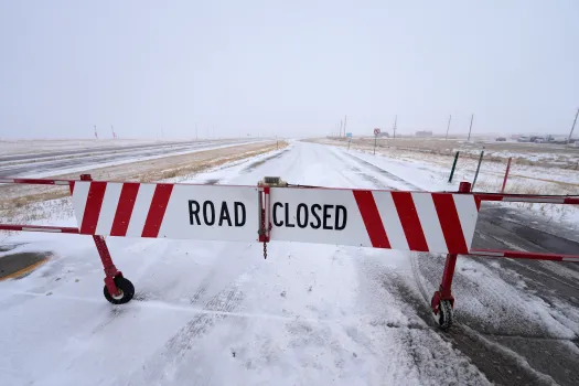
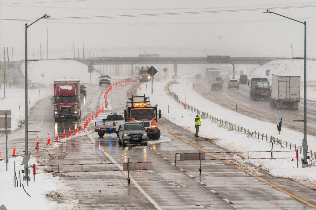
With snow piling up and wind gusts hitting 50 mph, driving will be extremely dangerous, if not impossible, in some areas. The Colorado Department of Transportation is warning that roads could become icy and snow-covered quickly, especially on steep grades and high mountain passes. If conditions worsen, some roads may be shut down entirely to keep travelers safe. Drivers should expect delays, slow speeds, and poor visibility throughout the storm. Officials are urging motorists to only travel if necessary and to carry an emergency kit with blankets, food, water, and a flashlight in case they get stranded. “Even if roads look fine in the morning, conditions could change quickly,” said a CDOT spokesperson. “People need to take this storm seriously and plan.”
Weekend Forecast—Cold and Snowy
The storm will continue into Saturday, bringing more snow and dropping temperatures fast. Highs will hover in the 50s early in the day before plunging into the 20s by nightfall. By Sunday morning, the snow should taper off, but cold temperatures and lingering ice could still make roads dangerous. Travel impacts could stretch into the start of next week, especially if roads remain slick.
How to Stay Safe During the Storm
- Delay travel if you can- If you don’t have to go out, stay home.
- Slow down- If you must drive, take it slow and leave plenty of space between vehicles.
- Prepare for possible power outages- Strong winds and heavy snow could bring down trees and power lines.
- Dress in layers- Wind chills could make it feel even colder, so bundle up if you’re heading outside.
- Check road conditions before traveling- The latest updates can be found on CDOT’s travel info website.
Colorado is no stranger to winter storms, but this one has the potential to cause major headaches for travelers and residents alike. Stay informed, stay safe, and be ready for whatever this storm throws your way.