

Washington residents, whether you’re in the nation’s capital or the Evergreen State, prepare for a week of diverse weather conditions. From snow showers to sunny skies, here’s a detailed breakdown to help you plan your week.
Washington, D.C. Current Conditions
As of this morning, the nation’s capital is experiencing mostly cloudy skies with a temperature around 40°F (4°C). A morning shower is possible, but clouds are expected to break later in the day, making way for breezy and milder conditions.
Washington Weekly Forecast:
- Sunday, February 9: After a potential morning shower, anticipate clouds breaking with breezy conditions. The high will reach approximately 48°F (9°C), with a low around 30°F (-1°C). It’s a good idea to carry an umbrella in the morning and a jacket for the evening chill.
- Monday, February 10: The day starts mostly cloudy, transitioning to sun through high clouds in the afternoon. Expect a high near 47°F (8°C) and a low of 30°F (-1°C). Layering your clothing will keep you comfortable throughout the day.
- Tuesday, February 11: Colder temperatures accompany the onset of snow in the late morning, with accumulations between 2 to 4 inches (5-10 cm). Road conditions will deteriorate rapidly, leading to slow and slippery travel. The high will be around 35°F (2°C), with a low of 30°F (-1°C). Consider telecommuting if possible and avoid unnecessary travel.
- Wednesday, February 12: A little snow may fall early in the morning; otherwise, expect cloudy and cold conditions. The storm’s total snowfall could reach 1 to 2 inches (3-6 cm). Morning travel may be slow and slippery, with rain and ice expected at night. The high will be near 36°F (2°C), with a low around 32°F (0°C). Exercise caution during your commute and stay updated on weather advisories.
- Thursday, February 13: Periods of rain are likely in the morning, followed by mostly cloudy and warmer conditions. The high will climb to about 53°F (12°C), with a low dropping to 26°F (-3°C). It’s advisable to carry an umbrella and wear waterproof footwear.
- Friday, February 14: Partly sunny skies will prevail, with a high near 46°F (8°C) and a low of 28°F (-2°C). It’s a pleasant day for outdoor activities, but keep a light jacket handy.
- Saturday, February 15: The week concludes with a thick cloud cover and periods of snow, sleet, freezing rain, and rain in the morning, transitioning to a little rain in the afternoon. The high will be around 42°F (6°C), with a low of 41°F (5°C). Plan indoor activities and stay updated on weather developments.
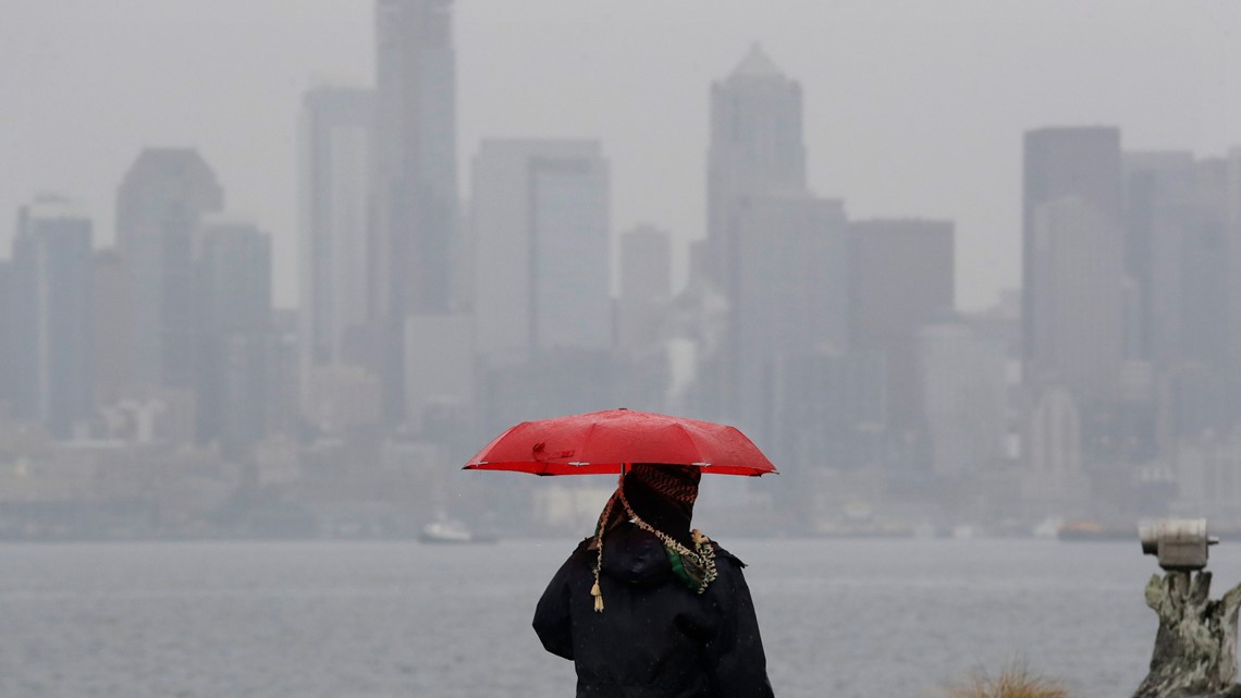
Seattle, Washington Current Conditions
Seattle is currently experiencing snow with a temperature of 35°F (2°C). Residents should be prepared for chilly conditions and potential snow accumulation.
Seattle Weekly Forecast:
- Sunday, February 9: Mostly cloudy and chilly conditions are expected, with a high of 42°F (5°C) and a low of 27°F (-3°C). A slight chance of snow showers exists after midnight. It’s advisable to dress warmly and be cautious of slippery roads.
- Monday, February 10: The day will be chilly, starting with cloudy skies in the morning, and then intervals of clouds and sunshine in the afternoon. The high will be around 41°F (5°C), with a low plunging to 21°F (-6°C). Bundle up to stay warm during outdoor activities.
- Tuesday, February 11: Anticipate mostly sunny and cold conditions, with a high near 37°F (3°C) and a low of 20°F (-6°C). It’s a good day to enjoy the sunshine, but ensure you’re dressed appropriately for the cold.
- Wednesday, February 12: Sunny to partly cloudy skies will dominate, with temperatures remaining cold. The high will be approximately 39°F (4°C), with a low of 24°F (-5°C). Layering your clothing will help maintain comfort throughout the day.
- Thursday, February 13: Plenty of sunshine is expected, but temperatures will remain chilly. The high will reach about 42°F (6°C), with a low of 29°F (-2°C). Sunglasses and a warm coat are recommended.
- Friday, February 14: Sunny and chilly conditions continue, with a high near 44°F (7°C) and a low of 34°F (1°C). It’s a pleasant day for outdoor plans, but keep warm clothing handy.
- Saturday, February 15: The week concludes with cloudy skies and a high of 45°F (7°C), with a low around 41°F (5°C). There is a chance of rain and snow, so monitor local weather updates for the latest information.
Safety Tips:
- Stay Informed: Weather conditions can change rapidly. Regularly check local weather updates and alerts to stay ahead of any sudden changes.
- Travel Caution: On snowy and icy days, roads can become slippery, and visibility may be reduced. If you’re driving, reduce your speed and maintain a safe distance from other vehicles. Pedestrians should be cautious of icy sidewalks and use crosswalks.
- Dress Appropriately: Layer your clothing to stay comfortable as temperatures fluctuate throughout the day. Waterproof attire and sturdy footwear are advisable on snowy and rainy days to keep you dry and prevent slips.
By staying informed and prepared, residents of Washington, D.C., and Washington State can navigate the week’s varied weather conditions safely and comfortably.