
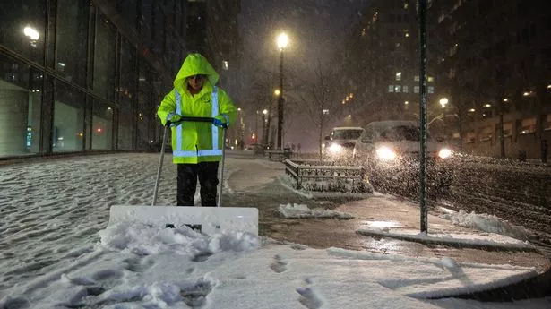
South Dakota is in the grip of a severe Arctic outbreak, bringing dangerously cold temperatures, relentless wind chills, and snow in many areas. The conditions could turn life-threatening for anyone exposed to the elements for too long. State officials are urging residents to take precautions as temperatures plummet to some of the coldest levels seen this season. As of today, much of the state is experiencing bitter cold, with temperatures hovering just above or below zero. In Sioux Falls, snow is falling lightly as the temperature struggles to reach 2°F (-17°C). Rapid City, while seeing sunshine, isn’t much better at just 4°F (-16°C). Meanwhile, Pierre is locked in the deep freeze at 0°F (-18°C). These numbers don’t even factor in the wind chill, which makes it feel even colder.
How Cold Will It Get?
South Dakota residents should prepare for a prolonged stretch of dangerously cold weather. The worst of it will come tonight when temperatures drop to extreme subzero levels across the state. In Sioux Falls, the low will plunge to a brutal -19°F (-28°C), while Rapid City and Pierre won’t fare much better, both dipping below -10°F (-24°C). When you factor in the wind, it will feel even colder, with wind chills making it feel like -35°F or worse in some areas. These conditions could cause frostbite in as little as 10 minutes, making any prolonged exposure outside extremely risky.

The Forecast: What’s Coming Next?
- Sioux Falls: The city will see light snow today, with minor accumulation. The deep freeze continues overnight, followed by sunshine on Thursday, but don’t expect any warmth—highs will only reach 10°F (-12°C). A slight warm-up is on the way by Friday, with highs near 28°F (-2°C), but snow could return in the afternoon.
- Rapid City: A mix of sun and clouds is expected today, with a high near 9°F (-13°C) before dropping to -5°F (-21°C) tonight. Thursday brings slight relief, with temperatures climbing to 30°F (-1°C). But Friday will bring brisk winds and colder conditions once again.
- Pierre: Temperatures remain bitterly cold today, reaching only 6°F (-14°C) with a nighttime low of -10°F (-24°C). Thursday will see slightly warmer conditions with a high of 23°F (-5°C), but clouds and possible snow showers return Friday as temperatures peak at 25°F (-4°C).
What You Need to Do to Stay Safe
- Avoid Prolonged Outdoor Exposure: Frostbite can set in within minutes in these conditions, so if you must go outside, bundle up in multiple layers, cover all exposed skin, and limit your time outdoors.
- Check on Vulnerable Individuals: The elderly, young children, and those without adequate heating are at the highest risk. Make sure loved ones and neighbors are safe and have what they need.
- Prepare for Possible Travel Disruptions: Snow and ice will make roads hazardous, and extreme cold can lead to vehicle breakdowns. Make sure your car is winter-ready and carry an emergency kit.
- Keep Pets Indoors: If it’s too cold for you, it’s too cold for them. Keep pets inside and limit outdoor walks.
Final Thoughts
This Arctic blast isn’t just another cold snap—it’s a serious weather event that demands attention. With wind chills dipping to dangerously low levels, even a short time outside can be risky. Take precautions, check in on those who may need help, and stay informed as conditions evolve. South Dakota is no stranger to winter’s wrath, but this week will be particularly brutal. Stay warm, stay safe, and be prepared for anything this extreme cold throws your way.