
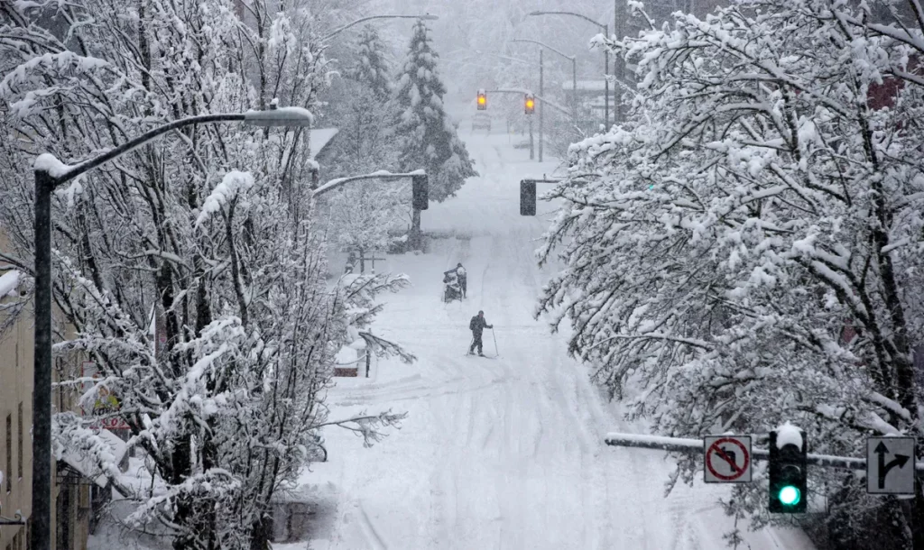
A powerful winter storm is about to make life miserable for residents across Eugene, Salem, and much of the Willamette Valley. The National Weather Service has issued an Ice Storm Warning from Wednesday night through early Friday, warning of dangerous road conditions, falling tree limbs, and possible widespread power outages. If you have plans to travel or be outdoors, you’ll want to rethink them now.
How Bad Will It Get?
This storm is shaping up to be a major winter event, with a mix of snow, sleet, and freezing rain creating a treacherous glaze of ice across the region. Forecasters say parts of the valley could see up to three-tenths of an inch of ice, with up to an inch of snow possible before the freezing rain takes over.

Areas north of Eugene, including Corvallis, Albany, and Salem, will see the heaviest ice buildup, but Eugene and Springfield are also in for a serious freeze. Roads, sidewalks, and driveways will be coated in ice, making walking and driving extremely dangerous.
Driving? Don’t Even Think About It
If you can stay off the roads, do it. Ice storms are far more dangerous than snowstorms because ice makes stopping and turning nearly impossible. Roads will soon turn into skating rinks, so the Oregon Department of Transportation is warning locals to avoid unnecessary travel.
Rural roads may become totally impassable, and bridges and overpasses will be the first to freeze. Because freezing rain adheres to pavement more quickly than road operators can remove it, even major highways may not be safe. Anticipate traffic jams, collisions, and maybe road closures.
Power Outages Could Leave Thousands in the Dark
One of the biggest concerns with this storm is falling trees and power lines. The weight of the ice could snap branches and bring down power lines, leading to widespread outages. If you lose power, it could take hours or even days to restore it, depending on the extent of the damage.
Make sure you’re prepared now:
- Charge your phones and flashlights
- Stock up on blankets and non-perishable food
- Have a backup heat source if possible
- Avoid using candles to prevent fires
When Will It End?
The worst of the storm is expected Wednesday night into Thursday, with conditions gradually improving on Friday as temperatures rise. Freezing rain will turn into regular rain, which should help melt some of the ice, but that could also mean falling ice and tree limbs—so stay alert even after the storm passes.
Stay Safe and Stay Informed
This storm has the potential to disrupt travel, damage property, and knock out power for days. The best thing you can do is stay home, stay warm, and stay updated on the latest weather alerts.