
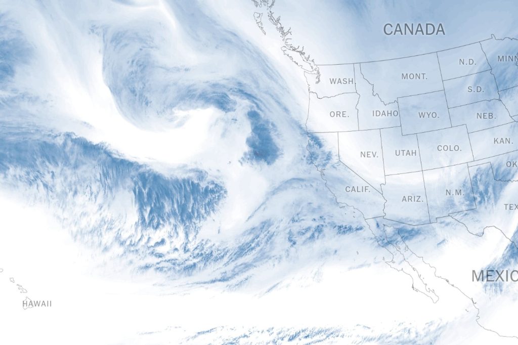
A massive atmospheric river is set to unleash torrential rain, strong winds, and heavy snowfall across California, raising concerns over flooding, landslides, and travel disruptions. Meteorologists warn that this storm could be one of the most damaging weather events of the season, with residents urged to take immediate precautions.
The National Weather Service (NWS) has issued storm warnings and flood watches for multiple areas, particularly those recently affected by wildfires, where the risk of mudslides and debris flows is significantly higher.
What to Expect from the Storm
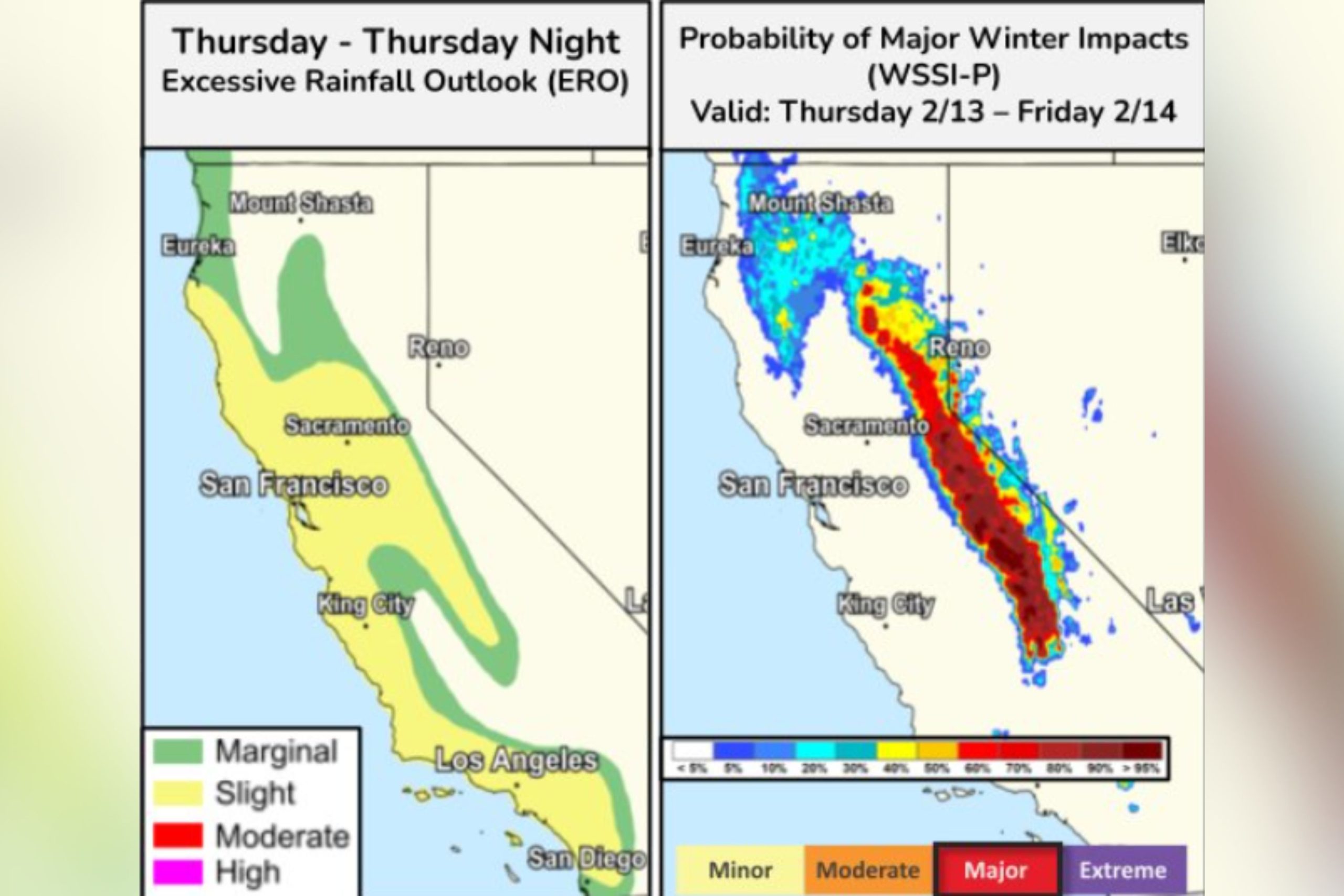
Heavy Rainfall and Flooding Risks
California’s coastal and inland regions are expected to receive up to 6 inches of rain, with even higher totals in mountainous areas. Urban flooding is a major concern, as excessive rainfall could overwhelm drainage systems, leading to road closures and travel disruptions.
Strong Winds and Potential Power Outages
The storm is bringing powerful wind gusts, which could reach up to 80 mph in coastal and elevated areas. These intense winds pose a serious risk of downed trees, flying debris, and widespread power outages. Officials are urging residents to secure outdoor objects and be prepared for possible blackouts.
Heavy Snowfall in the Sierra Nevada
While lower elevations face flooding, the Sierra Nevada mountains are expected to receive several feet of snow, creating dangerous travel conditions on mountain passes. Blowing snow and whiteout conditions could make roads virtually impassable, with road closures likely along major highways.
Safety Precautions for Residents
With the storm approaching, officials are urging residents to take precautions now to avoid serious impacts:
Avoid unnecessary travel – Roads will be hazardous, and flash flooding could make some areas impassable.
Prepare for power outages – Charge devices, stock up on batteries, and have backup lighting ready.
Monitor flood-prone areas – If you live near a river or burn scar, have an evacuation plan in place.
Secure loose objects – High winds could send outdoor furniture and debris flying.
Check on neighbours and vulnerable individuals who may need help preparing.
What’s Next?
Forecasters will continue to monitor the storm’s movement and update warnings as needed. The worst conditions are expected to hit late Thursday into Friday, with improving weather over the weekend.
For the latest updates, visit the National Weather Service’s Atmospheric River Portal or tune in to local news reports. Stay alert, stay safe, and be prepared as California faces another round of extreme weather!