
Colorado is experiencing a chaotic mix of extreme winter weather, with heavy snowstorms, treacherous road conditions, and life-threatening avalanche risks hitting the state. But in a dramatic shift, forecasters predict that after days of frigid temperatures and dangerous storms, much of Colorado will see a sudden warming trend just in time for the weekend.
Blizzards and Avalanches: A Deadly Week of Winter Weather
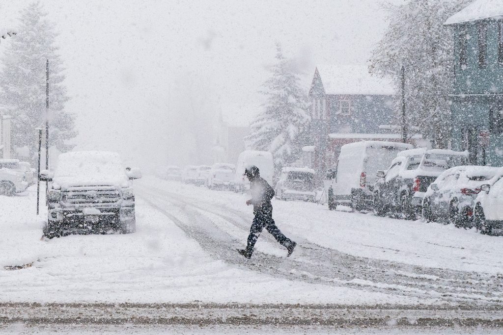
A powerful winter storm moved into the state earlier this week, dropping massive amounts of snow across the mountains and foothills. With strong winds and an unstable snowpack, conditions quickly became extremely dangerous for travelers and outdoor enthusiasts.
- Avalanche Warnings Issued – The Colorado Avalanche Information Center (CAIC) has issued a high avalanche warning for several mountain ranges, including the Park Range, Gore Range, Elk Mountains, and San Juan Mountains. Heavy snowfall and gusting winds up to 40 mph have created an unstable snowpack, making avalanches highly likely.
- Major Snow Accumulations –
- Denver Metro Area saw several inches of snowfall, leading to slick and hazardous road conditions.
- Aspen and Surrounding Areas received 7 to 14 inches of snow, making travel nearly impossible in some mountain passes.
- Vail and Breckenridge were buried under more than a foot of fresh snow, with even more expected in higher elevations.
- Dangerous Road Conditions – Icy highways, reduced visibility, and blowing snow have made travel nearly impossible in some parts of the state. Drivers are being urged to avoid mountain passes unless necessary.

Weather Whiplash: From Freezing to Spring-Like Temperatures
Just when it seemed like winter had taken over Colorado, the weather was about to do a complete 180. A shift in the jet stream will bring warmer air, causing temperatures to rise dramatically over the next few days.
-
Denver will go from freezing to mild temperatures:
- Saturday, Feb. 17: Cold with lingering snow, high of 31°F (-1°C).
- Sunday, Feb. 18: Partial sunshine, warming up to 40°F (5°C).
- Monday, Feb. 19 (Presidents’ Day): Cloudy but mild, high of 36°F (2°C).
-
Aspen and other mountain towns will also see improvements:
- Saturday: Cold with flurries, high of 30°F (-1°C).
- Sunday: Sunny to partly cloudy, warming to 35°F (2°C).
- Monday: More clouds, chance of light snow, but warmer at 36°F (2°C).
This quick change in temperatures could increase the risk of flooding in lower elevations, as melting snow adds excess moisture to rivers and streams.
What You Need to Know and How to Stay Safe
- Avoid Backcountry Travel – The avalanche risk remains extremely high. Anyone planning to ski, snowboard, or snowmobile in the backcountry should stay out of high-risk areas and check conditions frequently.
- Be Prepared for Changing Road Conditions – Even as temperatures rise, icy patches and sudden snow squalls are still possible. Keep emergency supplies in your car if traveling.
- Watch for Flooding in Low-Lying Areas – With rising temperatures, snowmelt could cause localized flooding in valleys and near streams.
- Enjoy the Warmer Weather, But Stay Aware – The warm-up is perfect for outdoor activities, but dressing in layers is key, as early mornings will still be cold.
Final Thoughts
Colorado’s weather has gone from brutal snowstorms and deadly avalanches to a surprise warm-up in just a matter of days. While the improving conditions are great for those looking to enjoy the holiday weekend, the risk of avalanches, treacherous roads, and sudden temperature swings still pose serious hazards. Whether you’re heading to the mountains for skiing or staying in the city for milder weather, be prepared for quick changes and stay alert to any new weather developments.