
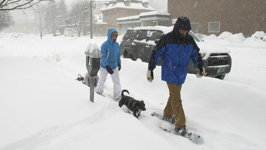
A dangerous winter storm is set to impact New Hampshire this weekend, bringing heavy snow, sleet, freezing rain, and life-threatening cold. The National Weather Service (NWS) has issued Winter Storm Warnings and Winter Weather Advisories across the state, warning residents of treacherous travel conditions, possible power outages, and extreme cold temperatures. The storm, expected to arrive late Saturday and continue through Monday, could bring up to a foot of snow in some areas, followed by a layer of ice that will make roads and sidewalks hazardous. After the storm, an Arctic blast will drop temperatures into the single digits and teens, making conditions even more dangerous.
Saturday: Snow Arrives, Travel Conditions Deteriorate Quickly
The storm is expected to begin Saturday afternoon, with snowfall rates increasing rapidly into the evening. Roads will become snow-covered and slippery, with visibility dropping to near zero at times.
- Concord: Snow starting in the afternoon, accumulating 3 to 6 inches by late evening. High of 27°F (-3°C), low of 23°F (-5°C).
- Manchester: Steady snowfall developing, with 4 to 7 inches possible before midnight. High of 30°F (-1°C), low of 25°F (-4°C).
- Portsmouth: Snow mixing with sleet overnight, making roads even slicker. High of 32°F (0°C), low of 26°F (-3°C).
Drivers should avoid traveling unless necessary, as plummeting temperatures will cause snow to freeze into a solid layer of ice overnight.

Sunday: Freezing Rain and Ice Create Treacherous Conditions
The worst conditions will arrive Sunday, as a mix of freezing rain and sleet moves across the state, coating roads, power lines, and trees in ice.
- Concord: Freezing rain in the morning, changing back to snow later in the day. Storm total of 6 to 10 inches of snow and up to 0.25 inches of ice. High of 29°F (-2°C), low of 13°F (-10°C).
- Manchester: Dangerous ice accumulation possible, followed by strong winds. High of 35°F (1°C), low of 17°F (-8°C).
- Portsmouth: Snow and sleet mixing with rain, making roads extremely hazardous. High of 36°F (2°C), low of 19°F (-7°C).
With ice building up on power lines, widespread power outages are a major concern, and wind gusts up to 30 mph could knock down tree branches.
Monday: Arctic Air Brings Bitter Cold and Icy Roads
As the storm moves out, an Arctic blast will bring frigid temperatures, keeping snow and ice frozen solid on roads and sidewalks.
- Concord: Frigid winds with a high of 24°F (-5°C), and a low of 6°F (-14°C).
- Manchester: Wind chills making it feel like -10°F (-23°C), with a high of 27°F (-3°C).
- Portsmouth: Bitter cold with icy sidewalks and roadways, high of 28°F (-2°C), low of 10°F (-12°C).
With temperatures struggling to rise above freezing all week, roads could remain icy and dangerous for days.
How to Stay Safe During This Dangerous Winter Storm
With the potential for heavy snow, ice, and dangerously cold temperatures, it’s crucial to take precautions now:
- Avoid Travel – Roads will be extremely hazardous, and black ice will make driving nearly impossible.
- Prepare for Power Outages – Ice accumulation and strong winds could knock out power—have flashlights, extra blankets, and backup heating sources ready.
- Bundle Up to Prevent Frostbite – Wind chills will make it feel even colder, so wear multiple layers, gloves, and a hat if heading outside.
- Check on Elderly Neighbors and Pets – Those without proper heating are at serious risk—make sure they have a warm, safe place to stay.
- Stock Up on Essentials – Groceries, medications, batteries, and emergency supplies should be stocked before the storm hits.
This isn’t just a typical winter storm—it’s a serious weather event that could make travel impossible, knock out power, and leave residents dealing with extreme cold for days. Officials are urging residents to stay indoors, stay warm, and be prepared. This storm has the potential to be deadly for those caught unprepared—don’t take any chances!