
Indiana is set to experience a dramatic and dangerous weather shift this weekend, with a combination of heavy rainfall, flash flooding, and an Arctic cold front bringing life-threatening temperatures. The National Weather Service (NWS) has issued flood watches, winter weather advisories, and wind chill warnings across the state, urging residents to take immediate precautions.
Saturday: Heavy Rain and Flooding Concerns
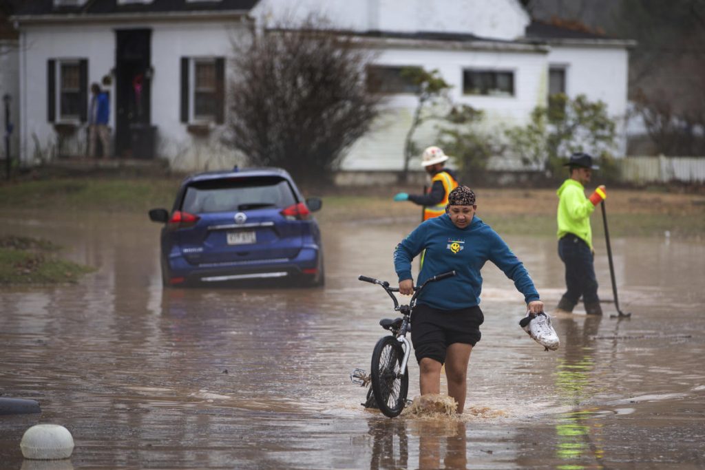
The weekend kicks off with intense rainfall, with some areas expecting up to 2 inches or more. The heaviest downpours will occur in central and southern Indiana, where saturated ground could lead to rapid flooding in low-lying and urban areas.
- Indianapolis: Periods of moderate to heavy rain throughout the day, with highs reaching 44°F (7°C) before temperatures begin to fall overnight.
- Fort Wayne: A mix of rain and wet snow, with colder air pushing in from the north. Temperatures will hover around 37°F (3°C) before dropping below freezing.
- Evansville: The wettest part of the state, with steady downpours leading to possible street flooding. Highs will reach 47°F (8°C) before conditions change dramatically overnight.
Officials are warning that creeks, rivers, and drainage systems could quickly become overwhelmed, leading to potential flash flooding. Avoid driving through flooded roads—just six inches of water can stall a car, and one foot can carry it away.

Sunday: Rapid Temperature Drop and Dangerous Cold
By Sunday morning, a powerful Arctic cold front will sweep through Indiana, bringing a dramatic temperature drop. What starts as rain early in the day will quickly transition to snow in many areas.
- Morning Temps in the 30s°F – By midday, temperatures will plummet into the teens, and by evening, some areas could be in the single digits.
- Dangerous Wind Chills – With gusty winds up to 30 mph, wind chills will make it feel like -10°F to -20°F across much of the state by Sunday night.
- Slippery Roads and Ice Formation – As temperatures drop below freezing, leftover rain will freeze, creating black ice on roads and sidewalks.
Monday: The Deep Freeze Sets In
By Monday morning, Indiana will be locked into its coldest stretch of the season, with temperatures struggling to climb above 15°F (-9°C) in many areas. Overnight lows will plunge into the single digits, with wind chills making it feel even colder.
- Indianapolis: High of 11°F (-12°C), low of -1°F (-18°C).
- Fort Wayne: High of 9°F (-13°C), low of -3°F (-19°C).
- Evansville: High of 15°F (-9°C), low of 4°F (-16°C).
Schools and businesses may see delays or closures due to the extreme cold and hazardous travel conditions. Frostbite can occur in as little as 10 minutes in these temperatures, so it’s crucial to limit outdoor exposure.
How to Stay Safe During This Extreme Weather Event
- Prepare for Power Outages – Heavy rain, strong winds, and freezing temperatures could lead to downed power lines and outages. Have flashlights, extra batteries, and warm blankets on hand.
- Avoid Flooded Areas – With rain turning to ice, driving conditions will go from dangerous to life-threatening in just hours. If you don’t need to be on the road, stay home.
- Layer Up and Protect Against Frostbite – If you must go outside, wear multiple layers, including hats, gloves, and thermal socks. Exposed skin can freeze in minutes.
- Check on Elderly Neighbors and Pets – Make sure vulnerable individuals have adequate heating and that pets are kept indoors.
Stay Alert and Take This Storm Seriously
This combination of flooding, snow, and Arctic cold could be one of the most dangerous weather events of the season for Indiana. Stay informed, stay indoors if possible, and take precautions now to keep yourself and your loved ones safe.