
Virginia residents are in for a chaotic weekend of extreme weather, with forecasters warning of torrential rain, dangerous thunderstorms, and a dramatic temperature drop that could lead to flash flooding and icy roads. The National Weather Service (NWS) has issued multiple alerts, urging Virginians to prepare for severe storms on Saturday, followed by a rapid freeze on Sunday that could make roads dangerously slick. Officials are warning that this storm system won’t just bring rain—it will bring flooding, strong winds, and freezing conditions all within 48 hours. Here’s what you need to know.
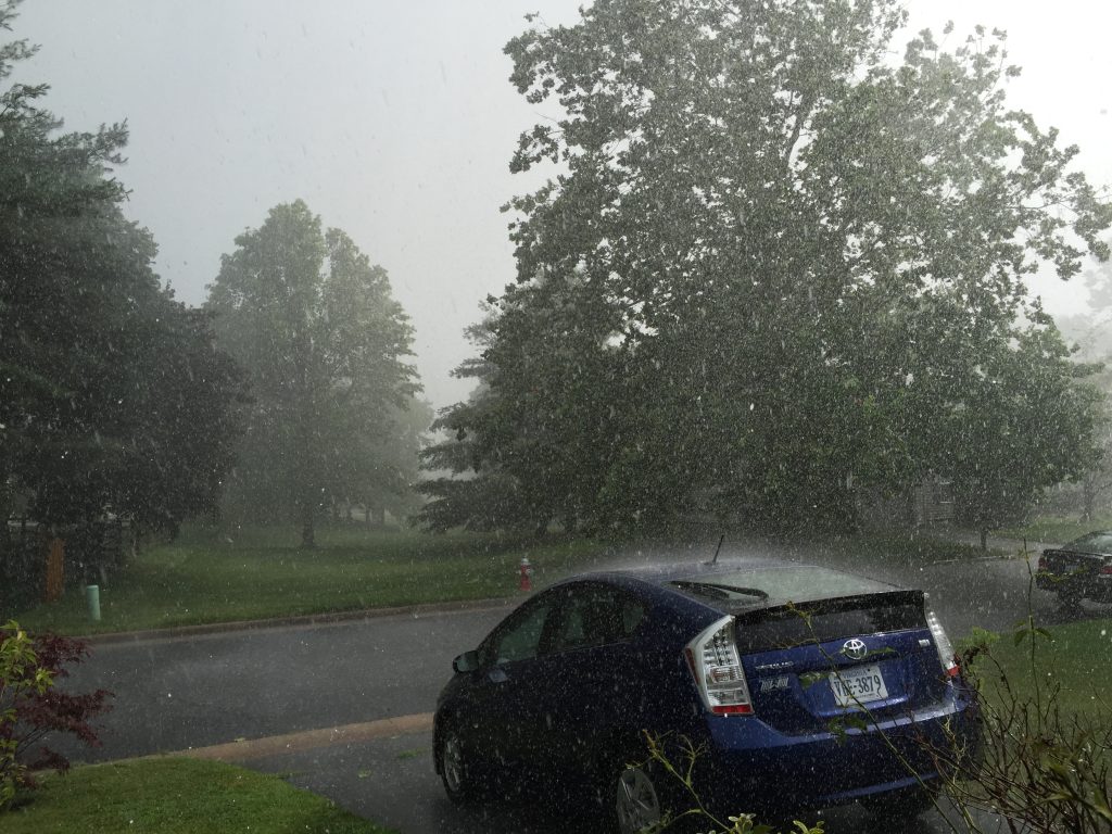
Saturday: Heavy Rain and Flooding Concerns
The weekend kicks off with widespread heavy rain, leading to potential flooding in low-lying areas and ponding on roads. As the storm intensifies, some locations could see over two inches of rainfall.
- Richmond: Expect steady rain throughout the day, with localized flooding possible by evening. High of 46°F (8°C), low of 40°F (5°C).
- Virginia Beach: Windy and rain-soaked afternoon, with potential for standing water on roadways. High of 54°F (12°C), low of 52°F (11°C).
- Roanoke: Persistent rain, heavy at times, increasing the risk of localized flooding. High of 38°F (3°C), low of 35°F (2°C).
With rain expected to continue overnight, officials are urging drivers to avoid flooded areas and prepare for deteriorating travel conditions.

Sunday: Severe Thunderstorms and a Dangerous Temperature Drop
Sunday will bring dramatic changes, as temperatures briefly rise into the 60s°F before a powerful Arctic cold front crashes through, sending temperatures plummeting in just a few hours.
- Richmond: Warm and stormy in the morning, followed by falling temperatures and strong winds. High near 67°F (19°C), dropping to 30°F (-1°C) by evening.
- Virginia Beach: Expect morning thunderstorms with damaging wind gusts up to 40 mph, before temperatures fall sharply at night. High of 68°F (20°C), low of 36°F (2°C).
- Roanoke: Morning rain, then a cold blast bringing freezing temperatures by sunset. High of 61°F (16°C), low of 29°F (-2°C).
This rapid temperature drop could cause flash freezing, where wet roads turn to sheets of ice within hours, making travel extremely hazardous. Drivers should avoid being on the roads late Sunday into Monday morning.
Monday: Bitter Cold and Lingering Ice Hazards
As the storm moves out, Virginia will be left locked in a deep freeze, with wind chills making it feel even colder.
- Richmond: Much colder, high of 44°F (7°C), low of 24°F (-4°C).
- Virginia Beach: Winds easing but still cold, with a high of 45°F (7°C), and a low of 32°F (0°C).
- Roanoke: Bitter cold with icy spots on roads, high of 39°F (4°C), low of 26°F (-3°C).
With temperatures remaining below freezing overnight, any remaining moisture on roads and sidewalks will refreeze, making conditions even more dangerous into Tuesday morning.
How to Stay Safe During This Hazardous Weather Event
With flooding, strong winds, and a flash freeze expected, here’s how to prepare:
- Avoid Driving Through Flooded Roads – Just six inches of water can stall your car, and one foot can sweep it away. Turn around, don’t drown!
- Prepare for a Sudden Freeze – Roads could turn icy within hours on Sunday night. Avoid unnecessary travel.
- Dress for the Cold – Wind chills will make it feel much colder than the actual temperature. Wear layers and cover exposed skin.
- Secure Outdoor Items – Strong winds could turn patio furniture and decorations into dangerous projectiles. Tie them down or bring them inside.
- Check on Elderly Neighbors and Pets – Make sure they have heat and emergency supplies for the sudden cold snap.
This isn’t just a routine winter storm—it’s a fast-moving, multi-phase weather event that could bring flash floods, damaging winds, and a dangerous freeze all within 48 hours. Stay indoors, stay warm, and stay informed. This storm has the potential to cause widespread disruptions—don’t take any chances!