
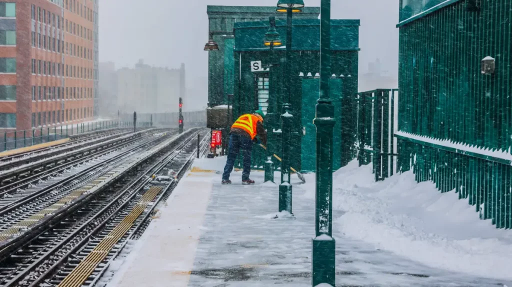
Residents of the Bronx are in for a brutal winter storm that is set to bring significant snowfall, icy roads, and dangerously cold temperatures over the next few days. The National Weather Service has issued a Winter Storm Warning, urging locals to prepare for hazardous travel conditions, bitter cold, and potential power outages as the storm moves in.
How Cold Will It Get?
- The cold snap has already begun, with temperatures in the Bronx hovering around 21°F (-6°C) this morning. Brisk winds are making it feel even colder, and the worst is yet to come. By Tuesday night, temperatures will drop to 15°F (-10°C), and the wind chill will make it feel close to zero.
- As we move into Wednesday, February 19, expect daytime highs to barely reach 30°F (-1°C), with nighttime lows dipping to 20°F (-7°C). Clouds will begin to roll in, setting the stage for Thursday’s snowfall.
- The coldest night of the week will be Thursday night into Friday morning, when temperatures will plunge to 21°F (-6°C), with biting winds making it feel even colder.
How Much Snow Will Fall?
The Bronx is expected to receive between 3 to 6 centimeters (1 to 2 inches) of snow on Thursday, but the combination of freezing temperatures and strong winds will make conditions even more dangerous. The snow will stick to roads, bridges, and sidewalks, creating hazardous conditions for commuters. City officials are warning residents to stay off the roads if possible, as black ice will make driving treacherous. Public transit could also face delays, so plan accordingly.

Day-by-Day Forecast for the Bronx
- Tuesday, February 18: Mostly sunny but very cold, with a high of 28°F (-2°C) and a low of 15°F (-10°C).
- Wednesday, February 19: Increasing clouds, cold and breezy, with highs around 30°F (-1°C) and lows near 20°F (-7°C).
- Thursday, February 20: Snow showers are expected in the morning, followed by flurries throughout the day. Highs around 29°F (-2°C), with nighttime lows at 21°F (-6°C). Roads will be slick and dangerous.
- Friday, February 21: Bitter cold continues but with clearing skies. Highs near 38°F (3°C), with overnight lows of 22°F (-6°C).
- Saturday, February 22: A slight warm-up, with highs reaching 40°F (4°C) and lows around 30°F (-1°C).
- Sunday, February 23: Partly cloudy with breaks of sunshine. Highs near 44°F (6°C), with lows around 33°F (0°C).
- Monday, February 24: Cloudy skies return, with highs reaching 46°F (8°C) and lows at 36°F (2°C).
How to Stay Safe During This Winter Storm
- Limit Travel – Icy roads and low visibility will make driving extremely dangerous. If you must travel, leave early and drive slowly.
- Dress in Layers – Wind chills will make it feel much colder than the actual temperature. Wear gloves, hats, scarves, and insulated clothing to protect against frostbite.
- Prepare for Power Outages – Snow and ice on power lines could lead to outages. Keep extra blankets, batteries, and non-perishable food on hand.
- Check on Elderly Neighbors and Pets – Those most vulnerable should not be exposed to extreme cold for long periods. Make sure they have access to heat and proper winter gear.
- Watch for Black Ice – Any snow or slush that melts during the day will refreeze at night, creating hidden dangers on roads and sidewalks.
Final Thoughts
The Bronx is facing one of its most significant winter storms of the season, with snow, ice, and dangerously cold temperatures making life difficult for residents. While the worst of the storm will pass by Friday, the deep freeze will linger into the weekend, and roads will remain slick and hazardous. If you haven’t already, now is the time to prepare. Stock up on essentials, stay informed with the latest updates, and take extra precautions if you must go outside. Stay safe, stay warm, and stay off the roads as this winter storm moves through the Bronx!