
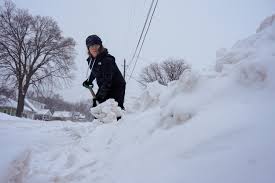
A powerful winter storm is set to bring heavy snow, freezing rain, and strong winds to Virginia, with forecasters warning of dangerous travel conditions, power outages, and significant disruptions through Thursday. The National Weather Service has issued a Winter Storm Warning for much of the state, urging residents to prepare for potentially life-threatening cold and hazardous conditions.
Snow, Ice, and Strong Winds to Create Dangerous Conditions
The storm is expected to begin early Wednesday morning, starting as light snow before intensifying throughout the day. By Wednesday evening, the snowfall will be heavy at times, with rates of 1 to 2 inches per hour in some areas. As temperatures fluctuate, parts of the state could experience freezing rain and sleet, making roads even more treacherous.
Forecasters predict total snow accumulations of 6 to 10 inches, with higher amounts possible in western Virginia. Ice accumulation could reach up to a quarter-inch in some locations, leading to the risk of downed power lines and tree damage. Wind gusts of 25 to 35 mph could further complicate conditions by causing blowing snow and reducing visibility.
Who Will Be Hit the Hardest?
The heaviest snowfall is expected in western and central Virginia, with some locations seeing over a foot of snow. Coastal regions will see less snow but more freezing rain, increasing the risk of black ice and power outages.
- Richmond – 6 to 9 inches of snow, with freezing rain possible
- Charlottesville – 8 to 10 inches of snow, with icy conditions overnight
- Roanoke – 7 to 9 inches of snow, with strong winds making travel hazardous
- Virginia Beach & Coastal Areas – 2 to 5 inches of snow, but freezing rain and sleet could cause major disruptions
Travel Nightmare Expected Across the State
State officials are warning that travel will be extremely hazardous, particularly from Wednesday night into Thursday morning. Major highways, including I-95, I-64, and I-81, are expected to become snow-covered and icy, with blowing snow reducing visibility to near zero at times.
Air travel is also likely to be affected, with flight delays and cancellations expected at Richmond International Airport and Dulles International Airport.
Public transportation may be impacted as well, as buses and trains could experience delays due to icy conditions.
Power Outages and Freezing Temperatures Pose Additional Threats
With ice accumulating on power lines, widespread power outages are a major concern. Utility companies are urging residents to prepare for extended outages, especially in areas where freezing rain is heaviest.
Temperatures are expected to remain below freezing for much of the week, meaning any snow and ice that falls will not melt quickly. This will likely lead to continued travel disruptions and dangerous conditions into the weekend.
How to Prepare for the Storm
- Avoid unnecessary travel. Roads will become dangerous quickly, and conditions will worsen throughout Wednesday and Thursday.
- Prepare for power outages. Charge your devices, have flashlights and batteries ready, and stock up on non-perishable food.
- Dress warmly. If you must go outside, wear multiple layers, hats, gloves, and waterproof boots to avoid frostbite.
- Check on vulnerable neighbours. Elderly individuals and those without adequate heating may need assistance.
- Monitor local weather updates. Stay informed through the National Weather Service and local emergency management agencies.
When Will the Storm End?
The heaviest snow is expected to taper off by Thursday morning, but cold temperatures will keep roads slick and dangerous for days. Snow removal efforts could be delayed due to ice buildup and strong winds, meaning travel disruptions may continue into the weekend.
Officials are urging residents to take this storm seriously and prepare now for what could be one of the most disruptive winter storms of the season. Stay tuned to local news and emergency alerts for the latest updates.