
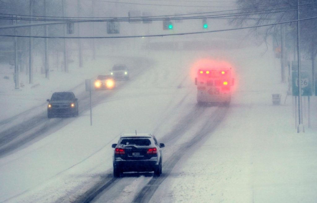
A powerful winter storm is set to sweep across Tennessee this week, bringing heavy snowfall, ice accumulation, and dangerous road conditions to many areas. The National Weather Service has issued winter storm warnings for several regions, urging residents to prepare for hazardous travel and potential power outages.
Major Snowfall Expected in Nashville
Nashville is gearing up for a significant winter storm, with a Winter Storm Warning in effect from 9:00 PM Tuesday to noon Wednesday. Forecasters predict 3 to 4 inches of snow, making roads slick and dangerous. Bridges and overpasses are expected to freeze first, causing major travel disruptions during the Wednesday morning commute. City officials advise residents to stay home if possible and prepare for icy conditions.
Memphis Faces Snow, Ice & Travel Dangers
Memphis is under a Winter Storm Warning from 12:00 PM Tuesday to 12:00 PM Wednesday, with expected snowfall between 1 and 6 inches, combined with a thin layer of ice. This combination will make roads extremely treacherous, and authorities warn of possible power outages due to ice accumulation on power lines. Residents are advised to stock up on essential supplies, including food, water, flashlights, and blankets, in case of electricity failures.

Knoxville to See Snow & Freezing Temperatures
Knoxville will also feel the storm’s impact, with a Winter Storm Watch in place for Tuesday night through Wednesday morning. Snow accumulations of 2 to 4 centimeters are expected, making untreated roads slippery. But the biggest concern is the bitter cold that follows. Temperatures will drop to a high of only 29°F (-2°C) on Thursday, making it one of the coldest days this winter.
Chattanooga to Get Light Snow & Icy Roads
While Chattanooga isn’t expected to see as much snow as other parts of the state, the city will still face light snowfall up to 1 centimeter on Wednesday. Although this may not seem like much, untreated roads and sidewalks could still become slippery, leading to hazardous conditions. Temperatures will hover near freezing, and residents should be cautious when driving or walking outdoors.
Clarksville Battles Flooding & Incoming Snowstorm
Clarksville is facing moderate flooding as the Cumberland River reaches 50.3 feet. Fortunately, floodwaters are expected to recede by Tuesday morning. However, the winter storm will soon follow, bringing 3 to 4 inches of snow Tuesday night into Wednesday. Residents should prepare for both lingering flood effects and dangerous road conditions due to snow and ice.
How to Prepare for the Storm
With freezing temperatures and heavy snow expected across the state, officials urge residents to take necessary precautions.
- Avoid unnecessary travel, especially during the storm. If you must drive, keep an emergency kit in your car, including a flashlight, food, water, and a blanket.
- Dress in layers and cover exposed skin to protect yourself from frostbite.
- Stock up on essential supplies, such as extra batteries, blankets, and non-perishable food, in case of power outages.
- Check on elderly neighbors and those who may need help staying warm during the extreme cold.
This winter storm could bring dangerous conditions across Tennessee. Stay updated with local weather alerts, and take the necessary steps to stay warm, safe, and prepared.