
Florida is bracing for a major weather shift that will bring heavy rain, thunderstorms, and a sharp drop in temperatures across the state. After enjoying warm, humid conditions, residents will now face a powerful cold front that will create hazardous travel conditions and potential flooding in some areas.
Storms and Soaking Rains Expected Across Central and North Florida
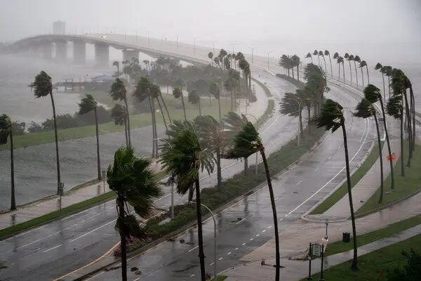
Meteorologists are warning that a band of heavy rain and thunderstorms will sweep through Central and North Florida, leading to flooded roads, delays, and disruptions to outdoor plans. The National Weather Service has issued advisories, urging people to stay alert for rapidly changing conditions.
In Orlando, the morning started warm at 69°F (20°C), but that will change quickly as showers and storms move in by the afternoon. Rain is expected to be heaviest between 3 PM and 7 PM, with downpours possibly causing delays during the evening rush hour. Temperatures will then begin to plummet overnight, reaching a low of 52°F (11°C).
Further north, Jacksonville and Tallahassee are already feeling the effects of the cold front, with steady rainfall and dropping temperatures. Jacksonville will see a high of just 57°F (14°C) before temperatures crash to 42°F (6°C) overnight. Meanwhile, Tallahassee will experience an even colder night, with lows plunging to 40°F (4°C).

Miami and South Florida Stay Warm—For Now
While North and Central Florida brace for storms and cold, South Florida, including Miami, will remain warm for another day. Forecasters predict record heat, with temperatures soaring to 82°F (28°C). However, even Miami won’t escape the coming cooldown. By Thursday night, a noticeable drop will bring lows down to 61°F (16°C), marking the start of cooler days ahead.
What to Expect in the Next Few Days
- Thursday, February 20 – Central and North Florida will remain chilly, with highs struggling to reach the mid-60s. South Florida will see slightly cooler temperatures but still mild conditions.
- Friday, February 21 – Morning lows will be cold, especially in Tallahassee and Jacksonville, where temperatures could dip into the 30s. Orlando will wake up to the mid-40s, while Miami will remain in the low-60s.
- Saturday, February 22 – The cool spell continues across most of the state, but a slow warming trend will begin. Highs will climb back into the upper 60s and 70s in some areas.
- Sunday, February 23 – Warmer air returns, bringing more typical Florida conditions, with highs in the upper 70s and low 80s statewide.
How to Stay Safe During Florida’s Weather Shift
With heavy rain, potential street flooding, and a sudden drop in temperatures, here’s how Florida residents can stay safe:
- Avoid Driving in Flooded Areas: Even a few inches of water can cause cars to lose control. If roads look flooded, turn around—don’t risk it.
- Dress for the Cold: While Florida isn’t known for extreme cold, a sudden drop can be dangerous, especially for young children and the elderly. Have warm layers ready.
- Secure Outdoor Items: Strong winds could accompany the storm, so bring in patio furniture, trash cans, and anything that could get blown away.
- Stay Weather-Aware: Check forecasts frequently, as conditions could change quickly. Be ready for delays or disruptions due to the storm.
Final Warning
This dramatic weather shift is a stark reminder that Florida’s climate isn’t always sunshine and beaches. With heavy storms, potential flooding, and a sharp temperature crash, residents should take precautions now to stay safe and comfortable over the next few days.