
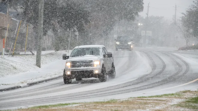
Georgia is preparing for a powerful winter storm that is set to bring freezing rain, dangerously cold temperatures, and hazardous road conditions across the state. The National Weather Service has issued a Winter Weather Advisory for parts of north Georgia, warning residents of dangerous travel conditions and the potential for power outages. The storm is expected to begin overnight Wednesday and continue through Thursday, with the worst impacts hitting early in the morning. Temperatures are expected to plummet below freezing, creating black ice on roads and bridges, making travel extremely dangerous. Officials are urging residents to stay off the roads unless necessary and prepare for potential power disruptions.
How Bad Will It Get? Freezing Rain and Icy Conditions Expected
The advisory is in effect for north Georgia, including Dade, Walker, Catoosa, and Fannin counties, where a dangerous mix of snow and freezing rain is expected. Light snow accumulations could make roads slick, but the real concern is freezing rain, which will coat streets, sidewalks, and power lines in ice.
Forecasters warn that even a thin layer of ice can make driving treacherous, leading to multi-car pileups and stranded vehicles. The Georgia Department of Transportation is pre-treating roads, but once temperatures drop, ice will form quickly, making travel extremely dangerous.
As of Wednesday morning, Atlanta is experiencing cloudy skies and steady rainfall, with temperatures hovering around 43°F (6°C). However, as the evening progresses, temperatures will fall sharply, reaching 25°F (-4°C) overnight, turning any remaining moisture into ice.

Georgia’s Weather Outlook: The Coldest Days of the Season Are Coming
- Thursday, February 20 – Partly sunny but bitterly cold, with highs barely reaching 37°F (3°C). Overnight lows will drop to 19°F (-7°C), increasing the risk of refreezing on roads.
- Friday, February 21 – A slight improvement, with sunshine but continued cold temperatures. Highs will be around 47°F (8°C), with lows near 27°F (-3°C).
- Saturday, February 22 – The beginning of a warming trend, with highs reaching 54°F (12°C). However, mornings will still be cold, increasing the risk of icy patches on the roads.
- Sunday, February 23 – Mostly cloudy and milder, with a high of 55°F (13°C). While warmer temperatures will help melt ice, black ice on roads during the morning hours remains a concern.
How to Stay Safe During Georgia’s Winter Storm
With freezing rain, ice, and dangerously low temperatures all converging, residents must take immediate precautions to stay safe.
- Avoid Travel: Roads will be slick and dangerous, especially during the early morning hours. If you must drive, carry emergency supplies, including a flashlight, food, water, and blankets in case of an accident or breakdown.
- Prepare for Power Outages: Freezing rain can snap power lines and bring down trees, leading to widespread blackouts. Make sure you have flashlights, batteries, warm clothing, and a backup heat source if the power goes out.
- Protect Your Pipes and Pets: Let faucets drip slightly to prevent pipes from freezing and bursting. Keep pets indoors, as the extreme cold can be deadly.
- Stay Informed: Monitor local news and weather updates for the latest forecasts and emergency alerts. Conditions can change quickly, so staying updated is critical.
This winter storm is shaping up to be one of Georgia’s most dangerous weather events this season. Officials are warning that the combination of freezing rain, dangerously low temperatures, and hazardous roads will create life-threatening conditions for anyone caught unprepared. The next 48 hours will be crucial—taking precautions now could mean the difference between safety and disaster.