
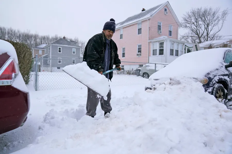
Long Island residents, get ready for a weekend of freezing temperatures and an unexpected round of snowfall. Forecasters are warning that an arctic blast will grip the region, bringing dangerously cold conditions, icy roads, and a wintry mix that could cause disruptions. If you’re planning to head outdoors, bundle up and prepare for a bitterly cold few days.
How Cold Will It Get?
As of today, February 22, 2025, temperatures are plummeting across Nassau and Suffolk counties. Nassau is already seeing light snowfall with temperatures hovering around 17°F (-8°C), making it one of the coldest mornings of the season. Meanwhile, Suffolk County is slightly warmer at 20°F (-6°C), but clear skies won’t offer much relief as frigid air continues to move in. The icy grip will tighten throughout the weekend, with overnight lows plunging into the teens. The bitter wind chill will make it feel even colder, increasing the risk of frostbite for anyone outside for too long.

Snowfall and Road Conditions
The snow will remain light but could cause slick roads, making driving conditions tricky. Even a thin layer of snow can create black ice, which is nearly invisible but extremely dangerous for drivers. Commuters and travelers should be extra cautious, especially in the early morning and late at night when roads are at their iciest. Snowplows will be out, but untreated roads could remain slippery for hours.
Day-by-Day Breakdown
-
Saturday, February 22 – Nassau County will struggle to climb above freezing, with daytime highs barely reaching 31°F (0°C). The nighttime low will dip to a bone-chilling 18°F (-8°C). Suffolk County will fare slightly better, with a high of 35°F (2°C) and a low of 25°F (-4°C).
-
Sunday, February 23 – A slight improvement is expected, but the cold remains relentless. Nassau County will see highs of 34°F (1°C) and lows of 20°F (-6°C) under cloudy skies. Suffolk County could see more sunshine, with temperatures ranging from 42°F (6°C) during the day to 26°F (-4°C) at night.
-
Monday, February 24 – The cold finally eases, but clouds will dominate the skies. Nassau County will warm up slightly, reaching 42°F (5°C) during the day and 34°F (1°C) at night. Suffolk County will see highs of 44°F (7°C) and lows near freezing at 32°F (0°C).
What Should You Do to Stay Safe?
- Bundle up! Wear multiple layers, cover exposed skin, and wear gloves, hats, and scarves to prevent frostbite.
- Drive carefully. Watch out for icy roads and black ice, especially in shaded areas and on bridges.
- Check on vulnerable individuals. Elderly neighbors, young children, and pets are at higher risk in extreme cold. Make sure they stay warm.
- Be prepared for power outages. High winds and freezing conditions can sometimes cause power disruptions. Have flashlights, blankets, and emergency supplies ready.
This surprise cold snap serves as a harsh reminder that winter isn’t done with Long Island just yet. While the worst of the season may be behind us, these temperatures prove that nature can always throw a curveball. Stay safe, stay warm, and stay tuned for more updates as conditions develop!