
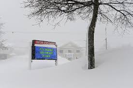
New Yorkers, get ready for a difficult and snowy morning. Parts of the state are experiencing a lake effect blizzard, and by 1 PM, up to 5 inches of snow are predicted. There will be a lot of snowfall, high winds, and slick roads if you’re in places like Buffalo, Syracuse, Rochester, or Watertown
What This Means for You
Heavy Snowfall – Snow is coming down quickly, with 1 to 3 inches per hour in some areas. Roads and sidewalks will get covered fast.
Strong Winds and Blowing Snow – Winds up to 40-55 mph could cause drifting snow and poor visibility, making it tough to see and drive safely.
Difficult Travel Conditions – Roads will be icy and hazardous. If you don’t need to drive, it’s best to stay home.
How to Stay Safe
Avoid Unnecessary Travel – If you must go out, drive slowly, leave plenty of space between cars, and carry an emergency kit with warm clothes, water, and a flashlight.
Be Ready for Power Outages: Snow and strong winds have the potential to bring down power lines. Keep blankets, batteries, and flashlights close at hand.
Check on Neighbors and Family – These conditions can be especially difficult for older adults or those who need extra assistance. A quick call or visit could make a big difference.

Why Is This Happening?
Lake effect snow is produced when cold air absorbs precipitation and releases it as snow on land as it moves over the Great Lakes. As lake temperatures rise due to global trends, these snow outbursts becoming stronger and more unpredictable.
Traveling and going about everyday tasks will be difficult during this storm, but being prepared can assist. As the day progresses, remain warm, stay safe, and monitor any updates.