

A major storm system is heading toward Houston, bringing the risk of severe thunderstorms, damaging winds, and even the possibility of tornadoes. The system is expected to arrive early Tuesday, bringing dangerous weather conditions right in the middle of the morning commute. If you live in or around the Houston area, now is the time to prepare.
When and Where Will the Storm Hit?
The storm system will move into Southeast Texas in the early hours of Tuesday morning, intensifying as it reaches Houston and surrounding areas. According to meteorologists, the most severe weather will likely occur between 8 a.m. and 1 p.m. This means thousands of Houstonians could be caught in the storm while heading to work or school, making travel extremely hazardous. Areas along and east of I-45—including Liberty, Chambers, Walker, Trinity, San Jacinto, and Polk counties—are at the highest risk of experiencing the most intense storms. Houston and surrounding communities will also feel significant impacts, with the possibility of dangerous wind gusts, hail, and heavy rain.
What to Expect: Damaging Winds, Large Hail, and Tornado Threat
Forecasters warn that this storm system carries several threats:
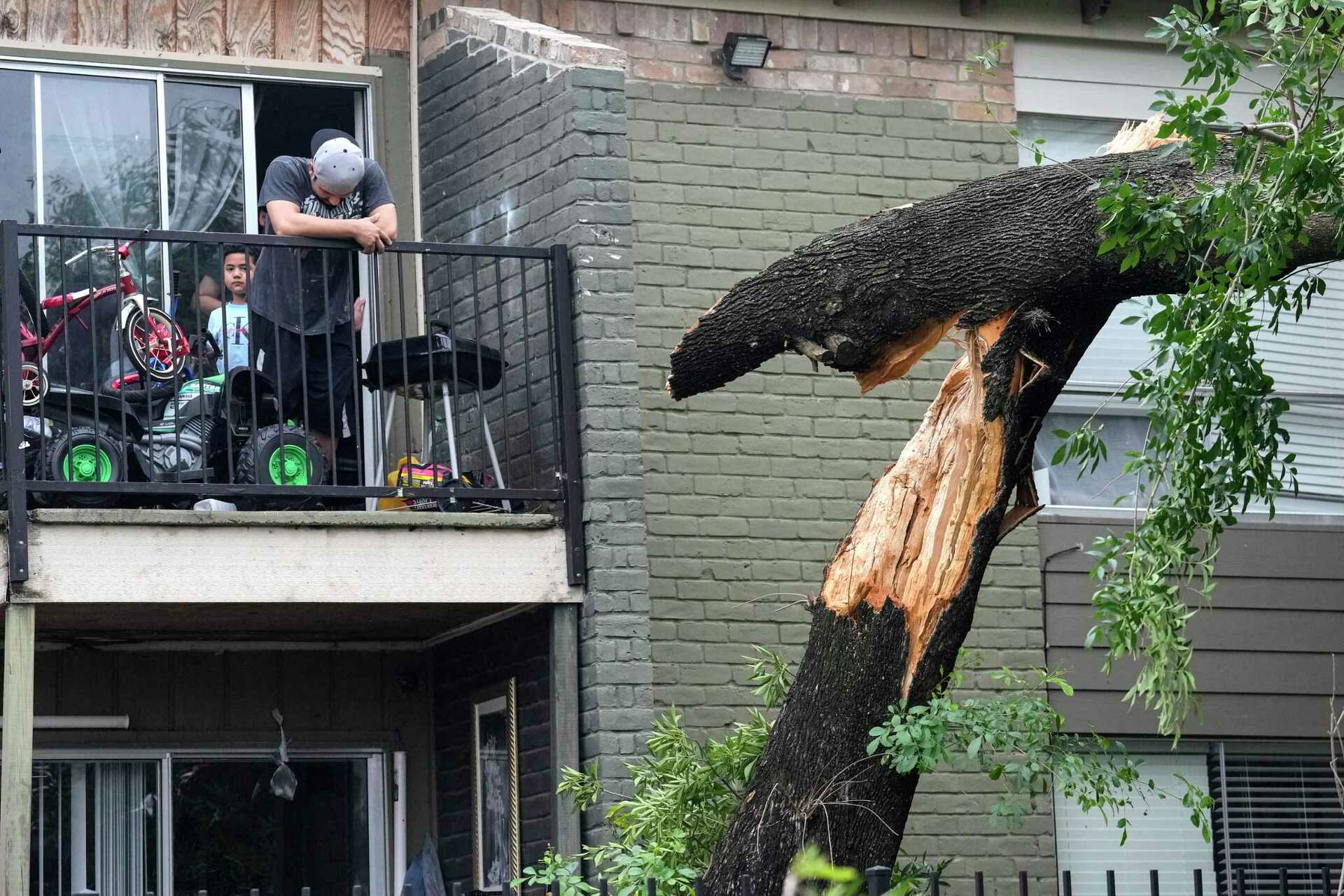
- Strong Winds: Wind gusts could exceed 40 mph in most areas, with isolated storms capable of producing even stronger winds over 60 mph. This could lead to power outages and fallen trees.
- Hail: Large hailstones are possible in the strongest parts of the storm. Hail can damage vehicles, homes, and outdoor structures.
- Tornadoes: There is a small but real risk of isolated tornadoes, especially in the counties east of I-45. While tornadoes are not guaranteed, even one could cause significant damage.
- Heavy Rain & Flash Flooding: Rapid downpours could overwhelm drainage systems, leading to street flooding, particularly in low-lying areas of Houston.
How to Stay Safe
With dangerous weather on the way, preparation is key. Here’s what you need to do now:
- Stay Weather-Aware: Watch trusted weather updates via TV, radio, or a weather app. Have a way to receive emergency alerts.
- Secure Loose Items: High winds can turn outdoor furniture, trash cans, and decorations into flying projectiles.
- Adjust Travel Plans: If possible, avoid driving during the storm’s peak hours. If you must travel, do so cautiously and avoid flooded roads.
- Have a Safety Plan: Know where to take shelter in case a tornado warning is issued. The safest place is in a small, windowless interior room on the lowest floor of your home or building.
What’s Next?
This storm system is expected to move out of Houston by the afternoon, but the aftermath could include power outages, fallen trees, and street flooding. City officials urge residents to remain cautious even after the storm passes. First responders and power crews will be on standby to handle emergencies. As the storm approaches, stay informed, be prepared, and prioritize safety. Houston has seen its fair share of extreme weather, but we can weather this storm together with the right precautions.