
Baldwin County residents need to brace for an extremely dangerous storm system set to hit the area tonight. The National Weather Service has issued an urgent alert for severe thunderstorms, tornadoes, powerful wind gusts, and flash flooding. With conditions expected to worsen overnight, this storm could cause major damage and life-threatening situations.
When Will the Storm Arrive?
Forecasters predict that the storm will move into Baldwin County late Tuesday evening and continue into early Wednesday morning. The most intense storms are expected between 10 PM and 3 AM, meaning much of the worst weather will occur while people are asleep. The storm is fueled by a clash of warm, humid air from the Gulf and a powerful cold front, creating the perfect setup for dangerous supercell thunderstorms. These conditions could lead to tornadoes, winds over 70 mph, and flash flooding in multiple areas across the county. By Wednesday morning, the storm will move out, but not before leaving behind significant damage, power outages, and possible road closures.

What Are the Biggest Threats?
This storm brings multiple severe threats that could significantly impact Baldwin County:
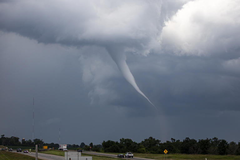
- Tornadoes: The risk for tornadoes is very high, with meteorologists warning that some could be strong and long-lasting. Tornadoes can develop quickly and cause widespread destruction, making it essential for residents to have a shelter plan in place.
- Damaging Winds: Winds could exceed 70 mph, bringing down power lines, trees, and even causing structural damage to homes and buildings. These winds could turn loose objects into deadly projectiles, so securing outdoor items is crucial.
- Flash Flooding: With intense rain expected to fall in a short period, areas with poor drainage or near rivers and creeks could see rapid flooding. Driving through flooded roads is extremely dangerous—turn around, don’t drown!
- Power Outages: Strong winds and falling debris could lead to widespread power outages, leaving many without electricity for several hours or even days.
How to Stay Safe and Prepare Now
With the storm arriving overnight, residents must take action now to ensure their safety. Here are essential steps to follow:
- Enable Emergency Alerts – Keep your phone fully charged and make sure emergency notifications are turned on to receive real-time warnings.
- Secure Outdoor Items – Bring in patio furniture, decorations, and trash cans to prevent them from being blown away.
- Prepare for Power Outages – Stock up on flashlights, extra batteries, and non-perishable food in case electricity is lost.
- Know Where to Shelter – If a tornado warning is issued, immediately move to a small, windowless room on the lowest floor of your home.
- Avoid Driving in Flooded Areas – Even a few inches of water can sweep a car away. If roads begin to flood, stay put and wait for the waters to recede.
This is not just another storm—it has the potential to cause major destruction across Baldwin County. With tornadoes, high winds, and flash flooding expected, taking the right precautions now can save lives. If you live in an area prone to flooding or tornadoes, have a plan in place and stay alert for emergency updates. Severe weather can develop quickly, so don’t wait until it’s too late to act!