
A massive and dangerous storm system is set to slam Illinois with destructive tornadoes, hurricane-force winds, and severe flooding over the next 48 hours. Weather experts are warning that this could be the most intense storm of the season, bringing life-threatening conditions across multiple regions.
What’s Happening?
A rapidly intensifying storm is sweeping across the Midwest, and Illinois is right in its path. According to the National Weather Service (NWS), this system is expected to bring tornadoes, winds reaching up to 55 mph, and heavy rainfall that could cause flash flooding in several areas. Forecasters say the worst of the storm will impact central and northern Illinois, including major cities like Chicago, Peoria, and Springfield. Strong thunderstorms are expected to develop late Tuesday night into early Wednesday morning, making overnight conditions especially dangerous for residents caught off guard.
Tornado Threat – What You Need to Know
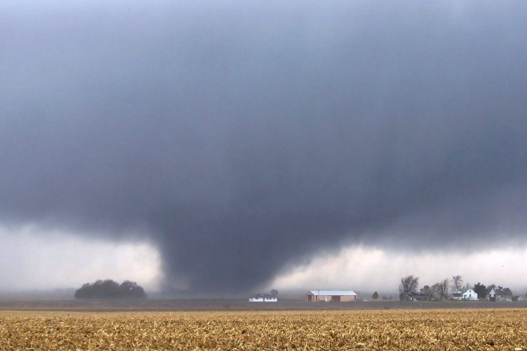
One of the most alarming aspects of this storm is the risk of tornadoes. The Storm Prediction Center has identified conditions favorable for rotating supercells, meaning twisters could form quickly with little warning. Tornadoes are most likely to develop in western and central Illinois, but even areas outside this zone should remain on high alert. If you hear a tornado warning, do not hesitate—seek shelter immediately! The safest places to be are a basement or an interior room away from windows.

Winds Strong Enough to Cause Widespread Damage
This storm is also packing hurricane-force wind gusts, with speeds reaching up to 55 mph. These winds are strong enough to bring down trees, power lines, and cause significant property damage. Power outages are very likely, and authorities are urging residents to charge phones, have emergency supplies ready, and prepare for possible blackouts.
Flash Flooding: A Growing Concern
Another major threat is the heavy rainfall expected to accompany the storm. Some areas could see up to 1.5 inches of rain, which may quickly overwhelm drainage systems and lead to flash flooding. Low-lying areas, especially in urban centers like Chicago, could see streets and highways turn into rivers. If you’re driving and encounter a flooded roadway, turn around—do not attempt to cross, as water levels can rise dangerously fast.
How to Stay Safe
With conditions set to deteriorate quickly, Illinois residents must act now to stay safe. Here’s what you need to do immediately:
- Monitor Weather Alerts – Stay updated through the National Weather Service, local news, and emergency alerts.
- Charge Your Devices – Power outages are likely, so make sure your phones, flashlights, and backup batteries are fully charged.
- Secure Outdoor Items – Bring in patio furniture, trash bins, and any loose objects that could become dangerous projectiles in high winds.
- Prepare an Emergency Kit – Stock up on non-perishable food, water, flashlights, and first-aid supplies.
- Have a Safe Shelter Plan – Know where you will go if a tornado warning is issued, and never ignore sirens or alerts.
- Avoid Flooded Roads – Never drive through standing water, as even a few inches can sweep away a vehicle.
Illinois residents must take this storm seriously. The combination of tornadoes, damaging winds, and heavy rain makes this one of the most dangerous storms of the year. Stay alert, stay indoors if possible, and be prepared for extreme conditions. This storm could cause widespread destruction, so taking the right precautions now could save lives. Do not wait—prepare immediately.