
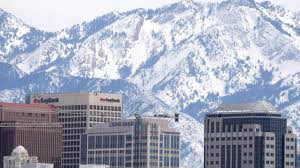
Salt Lake City, get ready for a week that will keep you on your toes! We’ll start off with some mild, spring-like weather, but don’t be fooled—by midweek, a cold front will crash the party, bringing rain, snow, and a serious temperature drop. Whether you’re planning a hike, a ski trip, or just trying to figure out what to wear, here’s your detailed breakdown of the week ahead.
Weekly Forecast Overview:
Monday, March 10: A Pleasant Start with Sunshine
Monday kicks things off with partly cloudy skies and mild temperatures. Highs will reach a comfortable 50°F (10°C), making it a great day to get outside and soak up the early spring vibes. Morning lows will be chilly at 32°F (0°C), so if you’re heading out early, you’ll want a jacket. Winds will stay light, and the day should feel relatively calm and pleasant.
Tuesday, March 11: Clouds Move In with a Chance of Rain
Tuesday starts off similar to Monday but with increasing clouds throughout the day. Highs will warm up to 54°F (12°C), but by late afternoon, there’s a slight chance of light rain showers. Evening temperatures will drop to 35°F (2°C), so expect a cool and possibly damp night. If you have evening plans, bringing an umbrella wouldn’t be the worst idea.
Wednesday, March 12: Rain Turns to Snow—Winter Makes a Comeback
This is where things take a turn! A strong cold front moves into the area, bringing morning rain that will transition into snow by the afternoon. Temperatures will start off at 55°F (13°C) but will quickly drop, with evening temps plummeting to 37°F (3°C). Snow accumulation is possible, especially in higher elevations, so be prepared for slick roads and reduced visibility.
Thursday, March 13: Cold, Snowy, and Blustery
Thursday will feel like we’ve traveled back in time to the heart of winter. Expect scattered snow showers throughout the day, with highs only reaching 46°F (8°C). Overnight temperatures will dip to 30°F (-1°C), so bundle up if you’re heading out in the evening. Roads may be icy, so drive with caution.
Friday, March 14: Clearing Skies but Staying Chilly
The snow showers will start to clear out by Friday morning, but temperatures will remain cold. Highs will struggle to get above 34°F (1°C), and overnight lows will drop even further to 26°F (-3°C). If you’re heading up to the mountains, fresh powder will be waiting for you, making it a great day for skiing or snowboarding.
Saturday, March 15: Cold but Sunny
The weekend kicks off with sunshine, but don’t let it fool you—it will still be cold. Highs will reach about 36°F (2°C), with overnight lows at 23°F (-5°C). While it’s not warm, it will be a great day to bundle up and enjoy outdoor winter activities.
Sunday, March 16: A Gradual Warm-Up Begins
By Sunday, we’ll start to see some signs of improvement. Highs will climb to 43°F (6°C), and the sun will make a welcome appearance. Overnight temperatures will remain chilly at 20°F (-6°C), but the trend toward warmer weather will be in motion.
Final Thoughts:
Salt Lake City’s weather this week is a true mix of seasons. We’ll start with spring-like warmth, only to be reminded that winter isn’t quite ready to leave just yet. The midweek snow and cold temperatures will make for some slick roads and icy conditions, so be prepared. By the weekend, we’ll start to warm back up, setting the stage for a milder trend next week. Stay tuned for updates and get ready for a little bit of everything!