
California is bracing for a major weather onslaught this week as back-to-back storm systems are set to bring heavy rain, flooding, and intense snowfall. Residents across the state should prepare for hazardous conditions, power outages, and travel disruptions as the storms make their way in.
Southern California: Rain, Flooding, and Travel Delays
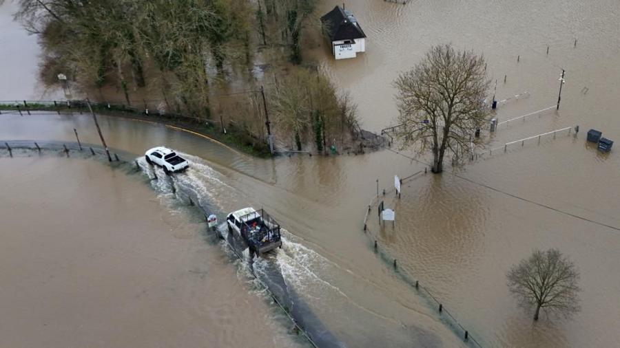
The first storm has already arrived, bringing light to moderate showers, but the real trouble begins on Wednesday night when a much stronger system takes over. This second storm will dump heavy rain across the region, significantly increasing the risk of flooding. A Flood Watch has been issued from Wednesday night through Thursday, covering areas from the coast to the mountains. One of the biggest concerns is the San Diego River, which could reach flood levels. Travelers should expect delays and potential road closures due to waterlogged streets and hazardous driving conditions.
Northern California: Thunderstorms, High Winds & Flooding Threat
Meanwhile, Northern California is preparing for an atmospheric river event that could drench the region with several inches of rain. The Bay Area is set to experience heavy downpours starting Tuesday night, with the heaviest rainfall expected on Wednesday morning. The North Bay and coastal mountains will be hit the hardest, with rainfall totals ranging between two to three inches, while lower elevations could see around an inch and a half. Thunderstorms are also expected, bringing the possibility of hail and strong winds that could knock down trees and power lines. Commuters should be prepared for slick roads and significant delays during the Wednesday morning rush hour.
Sierra Nevada: Major Snowstorm Could Shut Down Travel
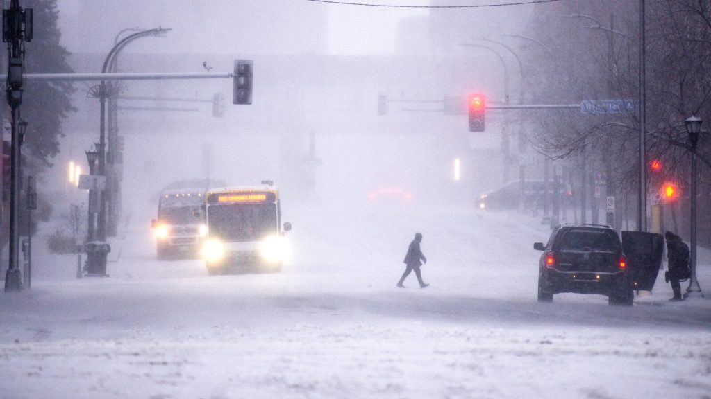
For those traveling in or around the Sierra Nevada, be prepared for what could be one of the season’s biggest snowstorms. Starting Tuesday night and lasting through Thursday, the region is expected to be buried under 2 to 3 feet of snow, with wind gusts reaching up to 70 mph. The most dangerous areas include Interstate 80 near Donner Pass and Highway 50 at Echo Summit, where near-whiteout conditions are expected. Snow levels will drop significantly, making travel through the mountains nearly impossible. Drivers should avoid non-essential trips and be prepared for widespread chain controls, long delays, or even road closures. Those already in the hills should stock up on supplies and prepare for potential power outages.
Safety Tips: Stay Ahead of the Storm!
- Avoid travel unless necessary, especially in flood-prone areas and the mountains.
- Prepare for power outages by keeping flashlights, batteries, and emergency supplies ready.
- Stay informed by checking local weather reports and emergency alerts.
- Watch out for flooding and be ready to evacuate if needed.
California residents should take this storm seriously and plan accordingly. With extreme weather conditions on the horizon, staying informed and prepared will be key to staying safe.