

A major storm system is on the move, threatening to bring tornadoes, damaging winds, and torrential rain to Alabama late Tuesday night and into early Wednesday morning. The National Weather Service has issued a high-risk warning, urging residents to take action now before the worst of the storm arrives. This system is expected to disrupt travel, knock out power, and cause significant damage across multiple counties.
When Will the Storm Arrive?
According to meteorologists, the storm is expected to begin moving into western Alabama late Tuesday evening, with the most intense weather hitting between 10 PM and 3 AM. The overnight timing makes this storm particularly dangerous, as many residents may be asleep when the worst conditions strike. The system is fueled by a powerful clash between warm Gulf air and an advancing cold front, creating the perfect conditions for severe thunderstorms, tornadoes, and flash flooding. Experts warn that some tornadoes could be strong and long-lasting, making it critical for residents to have a way to receive weather alerts overnight. By Wednesday morning, the storm will begin to weaken as it moves east, but not before leaving behind significant damage, fallen trees, and widespread power outages.
Biggest Threats to Alabama Residents
This storm system has the potential to bring multiple life-threatening weather hazards across the state, including:
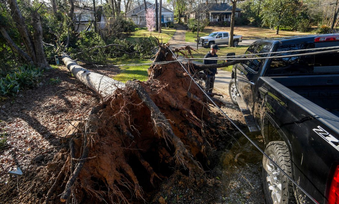
- Tornadoes: The risk of tornadoes is very high, particularly in central and northern Alabama. Forecasters warn that some could be EF2 or stronger, capable of leveling buildings and tossing vehicles. If a tornado warning is issued, take shelter immediately in a basement or a small, windowless interior room on the lowest floor.
- Damaging Winds: Winds are expected to gust between 60 and 70 mph, strong enough to knock down trees, power lines, and damage roofs and homes. Flying debris will be a serious hazard, making outdoor travel extremely dangerous.
- Flash Flooding: With several inches of rain expected in a short period, urban flooding and swollen rivers will pose serious risks. Low-lying areas and neighborhoods with poor drainage may see rapid water rise, making roads impassable.
- Power Outages: With high winds and falling debris, power outages are likely to be widespread and could last for hours or even days in some areas.
How to Stay Safe and Prepare Now
With a storm of this magnitude, preparation is key. Here’s how you can protect yourself and your loved ones:
- Stay Alert – Enable emergency alerts on your phone and have a battery-powered weather radio as a backup.
- Secure Loose Objects – Bring in outdoor furniture, trash cans, and decorations that could become airborne in high winds.
- Prepare for Power Outages – Have flashlights, extra batteries, bottled water, and non-perishable food ready in case of extended outages.
- Know Your Safe Zone – If a tornado warning is issued, move to an interior room with no windows or a basement immediately.
- Avoid Flooded Roads – Do not attempt to drive through floodwaters—it only takes a few inches of water to sweep a car away.
Looking Ahead
This dangerous storm system could bring catastrophic conditions to Alabama, with tornadoes, flash floods, and hurricane-force winds all possible. The overnight timing makes it even more critical for residents to be prepared ahead of time and have a way to receive emergency alerts. By taking the right precautions now, you can protect yourself, your family, and your home from potential disaster. Severe weather can develop rapidly, so stay informed, stay alert, and take action the moment warnings are issued. Alabama has faced storms before, but preparation is the key to staying safe.