

The New York Times’ interactive Malibu Quake Tracker offers a groundbreaking look into the subtle yet persistent seismic activity beneath this iconic coastal community.
With real-time data streaming from a network of local sensors, the tool provides both residents and scientists with critical insights into the earth’s movements. This innovative platform not only demystifies earthquake activity for the public but also reinforces the importance of preparedness and resilience in a region where even minor tremors can spark both curiosity and concern.
A Closer Look at the Technology
The Malibu Quake Tracker harnesses the power of state-of-the-art seismological monitoring systems, displaying detailed, real-time information on every recorded tremor.
Users can zoom in on specific areas, click on individual seismic events to learn about their magnitude, depth, and location, and observe patterns over time. This level of transparency transforms complex geological data into accessible and engaging information for everyone.
By presenting this data interactively, the tool bridges the gap between scientific research and everyday experience. “It’s like having a live feed of the earth’s heartbeat,” one local resident remarked.
For those who might be anxious about seismic activity, the tracker offers reassurance by contextualizing minor tremors as normal and ongoing processes that help relieve tectonic stress.
Community Impact and Preparedness
For Malibu residents, the tracker has become more than just an online tool—it’s a vital resource that promotes community awareness and safety. When the earth moves, even slightly, the tracker helps individuals understand that these events are part of the natural cycle of our dynamic planet.
Neighborhoods have begun using the tracker as a conversation starter about earthquake preparedness, encouraging residents to review emergency plans, secure heavy furniture, and identify safe spots within their homes.
Local schools have also integrated the tracker into their science curricula, helping students learn about geology and the earth’s structure through real-world data. “Seeing the tremors in real time makes the science come alive,” explained one teacher. This educational aspect not only empowers young minds but also reinforces a culture of readiness that benefits the entire community.
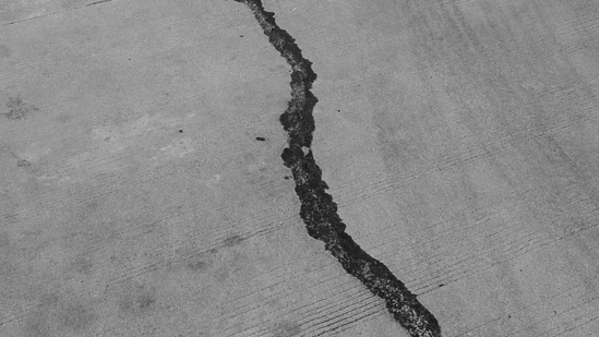
The Science Behind the Quakes
While Malibu is known for its sunny beaches and laid-back lifestyle, it lies in a seismically active region where small tremors are a regular occurrence. Experts note that these minor quakes, often registering around 2.0 to 2.5 on the Richter scale, are typically harmless yet serve as important indicators of the ongoing tectonic activity beneath the surface.
The tracker’s data helps scientists refine their models and improves our understanding of local fault dynamics—an essential component in predicting larger events and enhancing public safety.
“It’s not the big earthquakes that always matter; sometimes, it’s the little ones that tell us the most about what’s happening underground,” explained a local seismologist.
By monitoring these micro tremors, researchers can better anticipate changes in the earth’s behavior, ultimately contributing to more effective early-warning systems and improved infrastructure resilience.
Enhancing Public Trust Through Transparency
The Malibu Quake Tracker exemplifies the power of transparency in building public trust. By making seismic data readily accessible, the New York Times is empowering residents with the knowledge they need to feel secure in their environment.
This level of openness is critical in a world where natural hazards are often shrouded in uncertainty. With real-time insights into earthquake activity, community members can make informed decisions and feel more confident in their ability to respond to unexpected events.
Local officials have praised the initiative, emphasizing that informed citizens are better prepared citizens. “When people understand what’s happening beneath their feet, it demystifies the process and helps reduce unnecessary panic,” noted a county emergency management official.
This proactive dissemination of information fosters a more resilient community, one that is prepared to face the challenges of living in a seismically active region.
Looking to the Future: Resilience and Innovation
As technology continues to advance, interactive tools like the Malibu Quake Tracker will play an increasingly important role in our understanding of natural phenomena.
The data collected not only benefits immediate safety measures but also contributes to long-term scientific research and policy development. Local and state officials are exploring ways to integrate such innovative technologies into broader emergency preparedness programs, ensuring that communities are better equipped to handle both small tremors and major seismic events.
The ongoing collaboration between scientists, journalists, and the public sets a promising precedent for the future of disaster preparedness. With each tremor recorded, we move closer to a world where data-driven insights lead to smarter, safer communities.
In Conclusion
The Malibu Quake Tracker stands as a testament to the power of modern technology in making our world more understandable and safer. By providing real-time seismic data in an accessible format, it not only educates and reassures the residents of Malibu but also enhances our collective ability to prepare for and respond to natural events.
As we continue to innovate and improve our monitoring systems, tools like this will be key in fostering a resilient community ready to embrace the dynamic nature of our planet.