
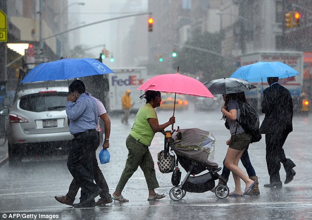
New Yorkers, get ready—Mother Nature is about to put on a show, and not the kind you want front-row seats for. A powerful storm system is making its way toward the city, bringing heavy rain, strong winds, and the potential for flooding. If you were planning a leisurely Sunday stroll or an evening out, you might want to rethink your plans.
What’s Coming and When?
The storm is expected to roll in later this afternoon, with rain intensifying as the evening progresses. The National Weather Service warns that downpours could be heavy at times, and strong winds will make conditions even worse.
- Timing: Expect the rain to start around 3–4 p.m., with the heaviest showers coming later in the evening.
- Rainfall: Forecasts predict 1 to 2 inches of rain, which could lead to flooding in low-lying areas and places with poor drainage.
- Winds: Gusts could reach 40–50 mph, especially in coastal areas, raising concerns about downed trees and power outages.
Why This Storm Is Serious
Sure, New York has seen its fair share of storms, but this one packs a punch. The combination of heavy rain and gusty winds increases the risk of:
- Flooded Streets: If you’re near flood-prone areas like Lower Manhattan or parts of Queens, keep an eye out for rising water.
- Falling Trees & Power Lines: The wind could bring down weakened branches, leading to power outages in some neighborhoods.
- Travel Headaches: If you need to be out, expect delays on subways, buses, and flights due to weather-related disruptions.

How to Stay Safe
This storm isn’t one to ignore, so here’s how you can prepare:
Secure loose objects—If you have patio furniture, garbage cans, or anything else that could fly away, bring it inside or tie it down.
Stay off the roads if possible—Heavy rain will reduce visibility, and slick streets increase the chances of accidents.
Charge your devices—If the power goes out, you’ll want your phone fully charged for updates and emergencies.
Avoid flood-prone areas—Even a few inches of water can be dangerous. Stay away from basements, underpasses, and waterfront areas.
Stay informed—Check local news and weather updates throughout the day.
What Happens After?
The worst of the storm is expected to pass by early Monday morning, with some lingering showers possible. The temperatures will stay mild, with highs around 56°F and lows near 37°F, but it’ll remain windy even after the rain stops.
This storm is part of a larger system that has already caused destruction in several states over the weekend, including tornadoes in parts of the South. While NYC won’t see tornadoes, the combination of rain, wind, and flooding makes this storm one to take seriously.
New Yorkers are resilient, and we’ve faced worse—but don’t take chances. Stay indoors, stay safe, and let this storm pass before heading out.