
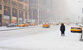
If you live in or around Watertown, brace yourself—winter is coming back with full force. The National Weather Service has issued a Lake Effect Snow Warning for the region, effective through early Monday morning. Forecasters predict heavy snow, with some areas possibly seeing 9 to 18 inches.
On top of that, winds could gust up to 40 mph, making roads dangerous and visibility poor. If you’re planning to travel, you may want to rethink it—conditions will likely be treacherous.
High Winds to Follow the Snow
As if the snow wasn’t enough, strong winds are on their way, too. Starting Monday morning, Jefferson County is under a High Wind Watch. Winds could hit 35–45 mph, with gusts as strong as 55 mph.
This could lead to falling tree branches, power outages, and tough driving conditions, especially for larger vehicles. If you have anything outdoors that isn’t nailed down, now’s the time to secure it.
Plattsburgh and Massena Won’t Be Spared
Snow and gusty winds will also impact Plattsburgh and Massena this weekend. Plattsburgh can expect a mix of snow showers and cloudy skies on Sunday, with temperatures peaking at 36°F and dipping to 20°F. By Monday, things turn even windier, making it feel much colder.
Massena will see similar conditions, with a few snow showers and breezy weather on Sunday, followed by stronger winds and additional snow on Monday. Temperatures will hover around 31°F during the day and drop to 19°F at night.
Here’s How You Can Prepare
- Stay Off the Roads If You Can: Heavy snow and poor visibility will make driving dangerous, especially in affected areas like Watertown.
- Get Ready for Power Outages: Charge your devices, stock up on flashlights, and have batteries handy.
- Secure Outdoor Items: Strong winds can send unsecured objects flying, so make sure everything is tied down.
- Stay in the Loop: Keep checking the latest weather updates and alerts for your area.