
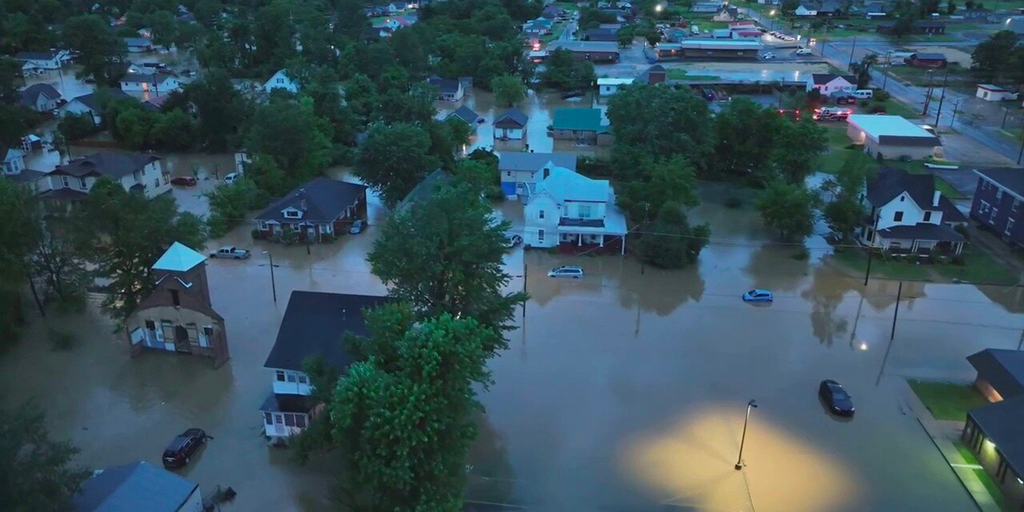
Western Kentucky is bracing for potential flooding as a powerful storm system moves into the area, bringing heavy rainfall. The National Weather Service has issued a Flood Watch, warning residents that up to 4 inches of rain could soak the region through Friday morning. Low-lying areas, riverbanks, and flood-prone neighborhoods face the greatest risk of water rising quickly, potentially leading to hazardous conditions.
What to Expect
- Heavy Rainfall: The storm will sweep in today and intensify overnight, with the heaviest downpours expected in western counties. Forecasters predict widespread rain totals of 1.5 to 2.5 inches, but some spots could see up to 4 inches, especially where storms linger.
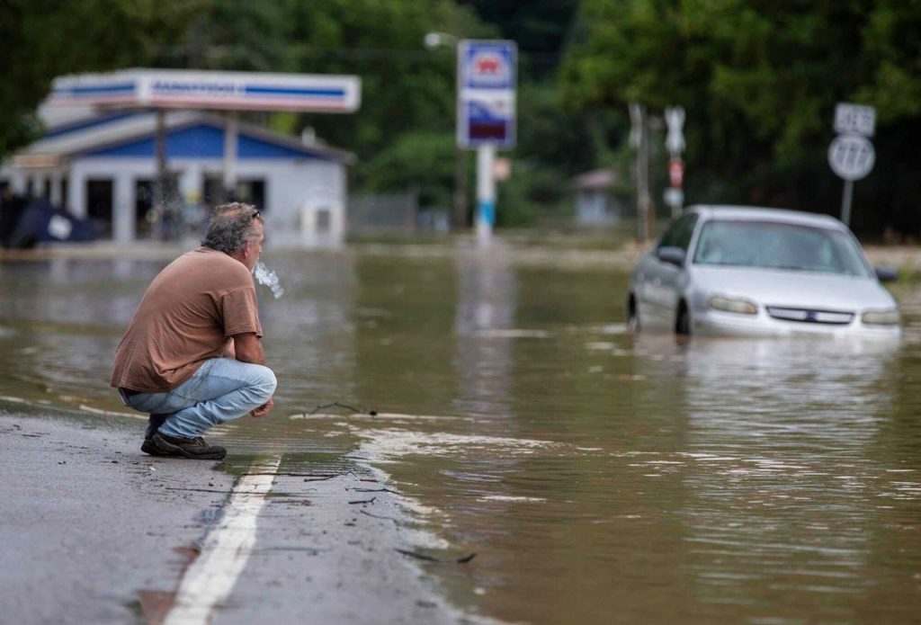
- Flash Flood Threat: Excessive rainfall could overwhelm drainage systems, causing rapid flooding in urban and rural areas.
- Rising River Levels: Rivers and streams are under close watch, as runoff from continuous rain could quickly swell waterways, creating the risk of overflowing banks.
Why This Storm Is Dangerous
The combination of saturated soil from recent precipitation and today’s heavy rain increases the chances of flash flooding. Floodwaters can rise rapidly, especially in low-lying areas, potentially cutting off roads and damaging homes and farmland.
Warnings Issued
Authorities are advising residents to avoid driving through flooded roads, where just a few inches of water can cause vehicles to stall or be swept away. Areas near creeks, streams, and rivers are at the highest risk for flash flooding. Travelers and residents are urged to stay updated through local alerts.
Safety Tips
- Avoid Flooded Roads: “Turn around, don’t drown” is the rule. Never attempt to drive through water-covered roads.
- Prepare Your Home: Clear gutters and storm drains to allow for proper water flow. Move valuables and important items to higher ground if necessary.
- Emergency Kit Ready: Ensure you have essentials like food, water, flashlights, and extra batteries in case of power outages or evacuation orders.

Looking Ahead
Rain is expected to ease by late Friday, but with water levels already high in some areas, flood risks could linger into the weekend. Residents should be prepared for potential road closures and detours as floodwaters recede.