
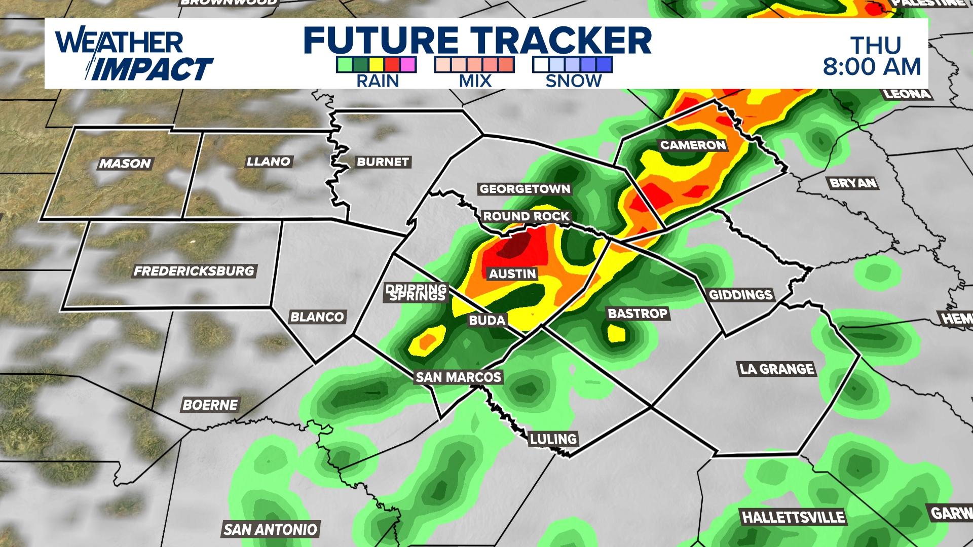
Central Texas is bracing for a turbulent night as severe storms are expected to sweep through the region, bringing damaging winds, large hail, and the threat of isolated tornadoes. The National Weather Service has issued warnings for areas along the I-35 corridor, including Austin, Waco, and Temple, with the most dangerous conditions expected to develop after midnight and last through Thursday morning.
Storm Details and Timing
A powerful storm system advancing from the west will collide with warm, humid air over Central Texas, creating an unstable atmosphere. Storms are expected to ignite late Wednesday night, intensifying in the early hours of Thursday. Heavy rain, lightning, and violent winds will accompany the storms, making the morning commute potentially hazardous.
Areas Most at Risk
- Austin: Thunderstorms are likely to strike in the early morning hours with strong winds and the possibility of hail.
- Waco: Heavy rain and thunderstorms could create flash flooding along with wind gusts up to 60 mph.
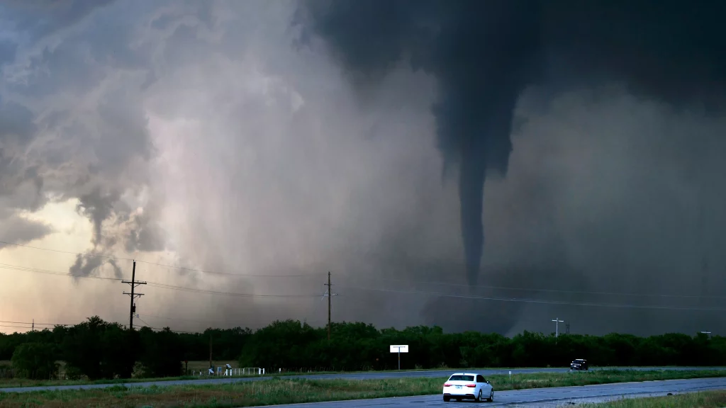
- Temple: Storms are expected to be strong, with the potential for brief tornadoes during peak activity.
Primary Threats
- Tornadoes: Isolated tornadoes could form quickly, especially during early morning hours when visibility is low, making it crucial for residents to stay alert.
- Damaging Winds: Gusts of up to 60 mph could down trees and power lines, leading to outages and blocked roadways.
- Hail: Some storms could produce large hailstones, potentially causing damage to vehicles and homes.
Why Overnight Storms Are More Dangerous
Severe storms that occur overnight pose a higher risk due to reduced visibility and people being asleep when warnings are issued. Tornadoes can form and travel quickly, giving little time to react. Officials are urging residents to have weather alerts activated on phones or weather radios to receive real-time updates.
What You Should Do:
- Stay Informed: Monitor weather updates through local news, NOAA radios, or mobile alerts.
- Secure Outdoor Objects: Bring in or secure patio furniture and outdoor items that could be thrown by strong winds.
- Prepare for Power Outages: Keep flashlights, extra batteries, and backup phone chargers ready in case of blackouts.
- Know Your Safe Space: Identify the safest place in your home to take shelter in case a tornado warning is issued.

After the storms pass by midday Thursday, Central Texas will experience cloudy and breezy conditions, with temperatures remaining in the 60s. However, officials warn that cleanup from downed trees and potential damage could take several days. Stay alert, Texas. This storm could pack a punch, and taking precautions tonight could save lives.