
Plumas County residents are being warned to prepare for a powerful winter storm that’s expected to bring heavy snow, high winds, and the risk of flooding over the next few days. With multiple weather alerts issued by the National Weather Service, officials are urging the community to take precautions before the storm intensifies.
A Calm Start Before Conditions Worsen
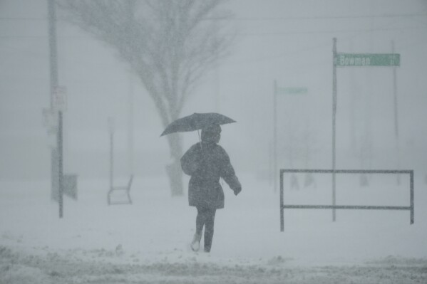
This morning, Quincy and surrounding areas in Plumas County are seeing light rain, with temperatures around 37°F (3°C). However, forecasters say this peaceful start won’t last long. By the afternoon, heavier rain will move in, turning to snow in higher elevations. Strong winds will make conditions even more dangerous, especially on mountain roads.
The Forecast: What to Expect
- Tuesday: Rain will be steady during the morning, becoming heavier in the afternoon. Mountain areas could see up to a foot of snow by nightfall, with gusty winds creating poor visibility. Highs will reach 48°F (9°C) before dropping to 28°F (-2°C) overnight.
- Wednesday: A mix of rain and snow is expected during the morning, with conditions remaining cloudy and chilly throughout the day. The high will be 44°F (7°C), and slippery roads are likely in higher elevations.
- Thursday: Another round of snow is forecast for the morning, with accumulations of 1 to 3 inches possible. Light rain will follow in the afternoon, and the high will hover around 41°F (5°C).
Winter Storm Warning: Dangerous Travel Expected
A Winter Storm Warning has been issued for areas above 5,500 feet until Wednesday morning. The heaviest snow will fall in the higher elevations, where accumulations of 1 to 3 feet are expected. Some of the highest peaks could see as much as 5 feet. Winds could gust up to 60 mph, making travel on mountain roads extremely dangerous or even impossible. Officials are recommending that residents avoid non-essential travel during this time.

Flood Watch in Low-Lying Areas
In addition to heavy snow, lower elevations will be dealing with rain and the risk of flooding. A Flood Watch is in effect for the county, and areas near rivers and creeks could see rising water levels. Poorly drained urban areas are also at risk of flooding, especially as runoff from the mountains flows downhill.
How to Stay Safe
- Avoid driving on flooded or snowy roads: Even shallow water can be dangerous, and snow-packed roads can be slippery. If you don’t need to travel, stay home.
- Prepare your home: Make sure gutters are clear, and outdoor furniture or loose items are secured to prevent wind damage.
- Pack an emergency kit: Include flashlights, batteries, bottled water, non-perishable food, blankets, and any necessary medications.
- Stay updated: Follow local news for weather updates and sign up for emergency alerts through the Plumas County Office of Emergency Services.
- Check on neighbors: If you have elderly or disabled neighbors, check in on them to make sure they’re prepared and have the supplies they need.
Power Outages and Road Closures Possible
With the combination of heavy snow and strong winds, power outages are likely, especially in rural areas. Power crews are on standby, but restoration could take time depending on the severity of the damage. Charge your phones and devices ahead of time, and have backup power sources ready if possible. Mountain roads and highways could also face closures due to snow or flooding. Be sure to check road conditions before heading out, and carry chains if driving through mountain passes.
When Will the Storm End?
The worst of the storm is expected to pass by Thursday evening, and conditions will begin to improve by Friday. The weekend looks calmer, with drier weather and a chance for sunshine. However, forecasters are warning that more storms could arrive next week, so residents should keep emergency supplies on hand.