
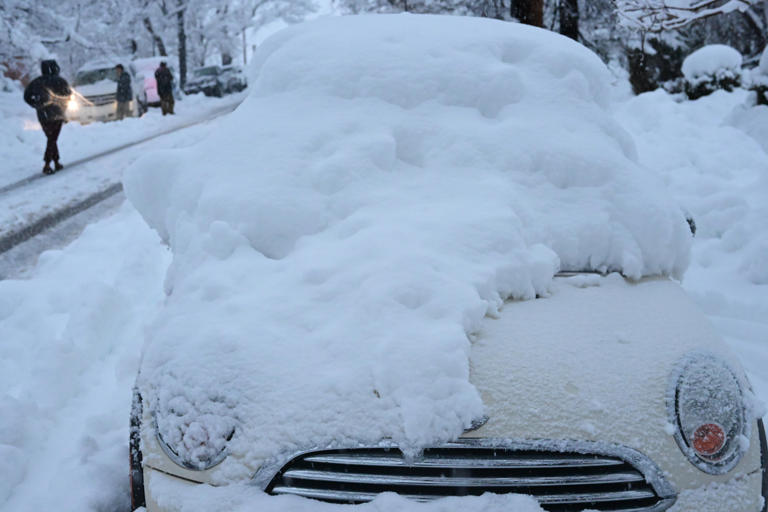
A monster winter storm is barreling across the central United States, bringing heavy snow, icy conditions, and bone-chilling winds to eight states. Forecasters are sounding the alarm as snowfall totals could hit 24 inches in some areas, and travel could become treacherous, if not impossible. Millions are urged to stay alert and take precautions as this winter weather event intensifies.
Winter weather warnings have been issued for Colorado, Wyoming, Nebraska, South Dakota, Minnesota, Wisconsin, Michigan, and New York. The storm, described by meteorologists as a “significant system,” will likely cause widespread disruptions, including power outages and dangerous travel conditions.
Snow and Ice Impact: Which Areas Are Hit the Hardest?
Colorado
Colorado is expected to see heavy snowfall in the mountain regions, while lower elevations, including Denver, will experience lighter snow and strong winds. The current temperature in Denver hovers around 30°F (-1°C), with a high of 51°F (11°C) today, but snow is expected to arrive as early as Tuesday.
Wyoming
In Wyoming, Cheyenne is already feeling the chill, with temperatures at 21°F (-6°C) and cloudy skies. Forecasters predict snow will begin Tuesday, with temperatures dipping to a freezing low of 2°F (-16°C). Roads across the region could become icy quickly, creating a major headache for travelers.
Nebraska
Nebraska’s Omaha is currently calm at 21°F (-6°C), but don’t let that fool you—by Tuesday, the city could be dealing with blizzard-like conditions. Forecasts show highs around 17°F (-8°C) and a chance for dangerous snow accumulations.
South Dakota
Sioux Falls in South Dakota is also preparing for winter mayhem. With a current temperature of 11°F (-12°C), the city is bracing for snow that could pile up fast. Highs will only reach 34°F (1°C) before dropping into the single digits by Saturday.

Minnesota
Minnesota, particularly Minneapolis, will face severe conditions with heavy snow and plunging temperatures. Right now, it’s 12°F (-11°C) under sunny skies, but snow is on the way. Residents could see between 6 to 12 inches of snow, with lows near -7°F (-22°C) overnight.
Wisconsin
In Wisconsin, Madison is under cloudy skies at 28°F (-2°C) but could soon be covered in fresh snow and ice. The high today will be 38°F (3°C), but expect a sharp temperature drop and snow showers through the weekend.
Michigan
Michigan’s capital, Lansing, sits at 29°F (-2°C) today, but snow and freezing rain are on the horizon. Roads may quickly turn hazardous, especially with icy patches forming overnight.
New York
Even Buffalo, New York, is not being spared. With a current temperature of 32°F (0°C) and a high of 36°F (2°C) expected today, residents should prepare for snow by Saturday evening.
Travel Nightmares and Power Outages Loom
The National Weather Service is warning that travel conditions could deteriorate rapidly as snow intensifies. Roads may become impassable, and icy conditions could lead to major accidents. Airports in the affected regions are already preparing for delays and cancellations. Power outages are another major concern, especially in areas with heavy, wet snow and freezing rain. The weight of the snow could bring down power lines, leaving thousands without electricity. Officials are urging residents to have emergency supplies ready, including food, water, batteries, and warm clothing.
How to Stay Safe
- Limit travel to emergencies only. If you have to be on the road, carry an emergency kit with blankets, food, and water.
- Prepare your home for power outages by charging devices and keeping flashlights and extra batteries handy.
- Stay tuned to local weather reports and follow instructions from officials if conditions worsen.
This storm could pack a dangerous punch, but with preparation, residents can ride it out safely. Stay indoors, stay warm, and don’t underestimate the power of this winter blast.