
Oregon is bracing for a major winter storm that is expected to bring heavy snowfall, freezing rain, and bitterly cold temperatures across much of the state this weekend. Forecasters warn that hazardous conditions could lead to dangerous travel, power outages, and icy roads, making this one of the most impactful winter events of the season. The National Weather Service has issued winter storm warnings and advisories for multiple regions, urging residents to prepare for worsening conditions. Snowfall is expected to begin on Saturday morning, continuing through Sunday with a mix of sleet and ice in some areas.
Friday: A Brief Calm Before the Storm
Don’t let Friday’s mild weather fool you—this is the last chance to prepare before the storm moves in.
- Portland: A partly cloudy day with light winds. High near 45°F (7°C), low of 36°F (2°C).
- Salem: Mostly cloudy with a slight breeze. High of 49°F (10°C), low of 37°F (3°C).
- Eugene: A mix of clouds and sunshine, with a high of 47°F (8°C) and a low of 34°F (1°C).
- Bend: Cold and mostly cloudy, high near 37°F (3°C), dropping to a frigid 19°F (-7°C) at night.
While Friday will feel relatively normal for winter, conditions will take a dramatic turn on Saturday.
Saturday: The Storm Moves In
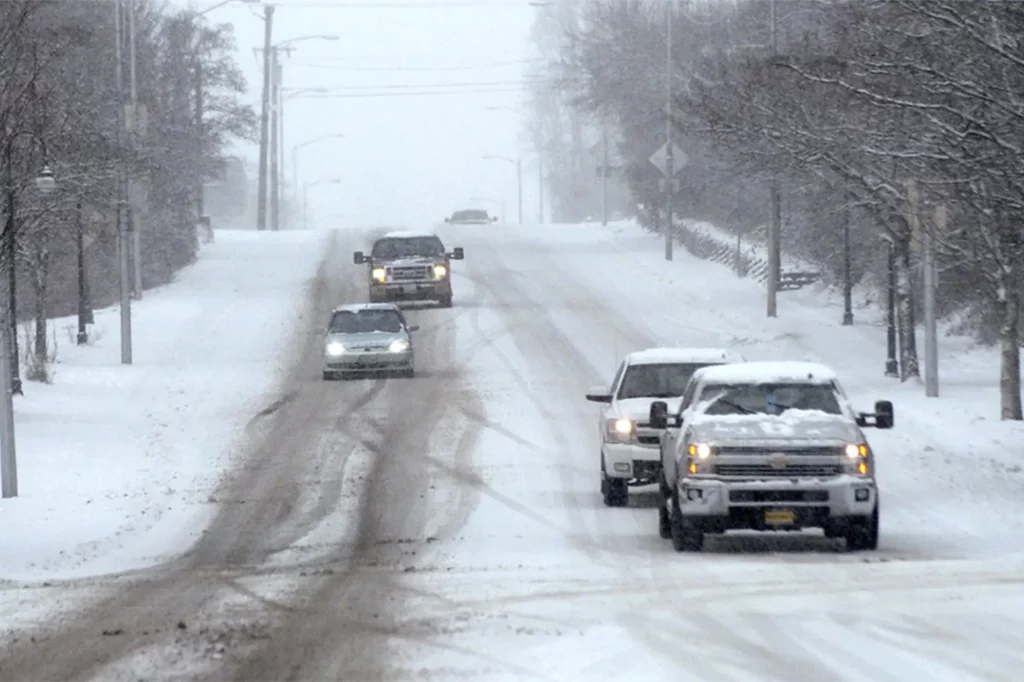
Saturday is when things get serious. Snow will begin falling early in the day, and some areas will see a mix of sleet and rain, creating dangerously icy conditions.
- Portland: A few early morning showers could turn into wet snow by evening. High of 45°F (7°C), low near 32°F (0°C).
- Salem: Rain and a mix of snow and sleet in the morning, followed by rain showers in the afternoon. High of 50°F (10°C), low of 34°F (1°C).
- Eugene: Snow and rain showers early, turning mostly cloudy in the afternoon. High near 47°F (9°C), low around 32°F (0°C).
- Bend: A mix of clouds and sun during the day, but temperatures will plummet at night. High of 40°F (5°C), dropping to a brutal 16°F (-9°C) overnight.
With freezing temperatures setting in after sunset, roads will turn slick and dangerous—travel will be treacherous, especially in the mountain passes and higher elevations.

Sunday: Snow Lingers, Arctic Air Arrives
The storm will continue to impact Oregon through Sunday, though snowfall totals will depend on location. Even as the system moves out, cold air will settle in, keeping ice and snow from melting.
- Portland: Intervals of clouds and sunshine. High of 45°F (7°C), low of 30°F (-1°C).
- Salem: Gradual clearing, but still cold. High of 45°F (7°C), low near 28°F (-2°C).
- Eugene: Partly sunny with lingering cold air. High of 47°F (8°C), low around 24°F (-4°C).
- Bend: Bitter cold continues, high near 36°F (2°C), low of 13°F (-10°C).
Even after the storm passes, freezing temperatures will keep untreated roads icy and dangerous.
How to Stay Safe in the Storm
With heavy snow, freezing rain, and dangerously low temperatures on the way, here’s how you can stay safe and prepared:
- Avoid unnecessary travel – Roads will be icy and visibility will be poor in snowy conditions. If you must drive, keep an emergency kit with blankets, food, and water in your vehicle.
- Prepare for potential power outages – Snow and ice could bring down power lines. Keep flashlights, extra batteries, and a backup heat source handy.
- Dress in layers – Wind chills will make it feel even colder than the actual temperature. Wear warm clothing, gloves, and hats to protect yourself from frostbite.
- Check on loved ones – The elderly, young children, and pets are especially vulnerable in extreme cold. Make sure they have a warm place to stay and enough supplies.
- Stay updated on the forecast – Storm conditions can change quickly. Keep up with the latest alerts from the National Weather Service and local news stations.
What Happens Next?
Even after this weekend’s storm moves out, the cold air will stick around. Forecasters are already tracking another potential system that could bring more snow to the Pacific Northwest next week.
- Monday: Cloudy and cold, high near 35°F (2°C), low of 22°F (-6°C).
- Tuesday: Another chance of snow, high of 34°F (1°C), low of 21°F (-6°C).
- Wednesday & Thursday: Dry but frigid, with highs struggling to reach the mid-30s and overnight lows in the teens and 20s.
Final Thoughts
Oregon is no stranger to winter storms, but this one will bring a dangerous combination of snow, ice, and brutally cold temperatures. Hazardous travel, power outages, and frigid conditions could make this a very difficult weekend. Stock up on supplies, avoid the roads if possible, and stay informed. This storm is serious, and preparation is key. Stay safe, stay warm, and be ready for what’s coming next!