
Oklahoma is in for a major winter storm this week, and residents need to prepare for freezing rain, ice accumulation, and dangerously cold temperatures. A strong system moving in by midweek is expected to turn roads into ice rinks, disrupt travel, and create life-threatening cold conditions in many parts of the state. The National Weather Service is warning of potential power outages, hazardous driving conditions, and the risk of frostbite due to extreme wind chills. If you have travel plans or need to be outside, now is the time to prepare for a brutally cold and icy stretch of weather.
Current Conditions: Calm Before the Storm
Right now, temperatures are in the low 30s°F (-1°C) in Oklahoma City, Tulsa, and other central parts of the state. Some areas are seeing partly sunny skies, but this will change quickly as cold air and moisture collide by Tuesday night.
Day-by-Day Forecast – Ice, Snow, and Dangerous Cold Incoming
- Sunday, February 9: Mostly cloudy and chilly, with highs in the mid-40s°F (7°C) and lows near freezing. No major weather issues yet, but don’t let this fool you.
- Monday, February 10: Expect clouds and scattered rain showers across much of the state, with highs around 39°F (4°C) and lows dipping to 33°F (1°C).
- Tuesday, February 11: Colder air moves in, with light rain transitioning to freezing drizzle by the evening. Highs stay near 35°F (1°C), and roads could begin icing up overnight.
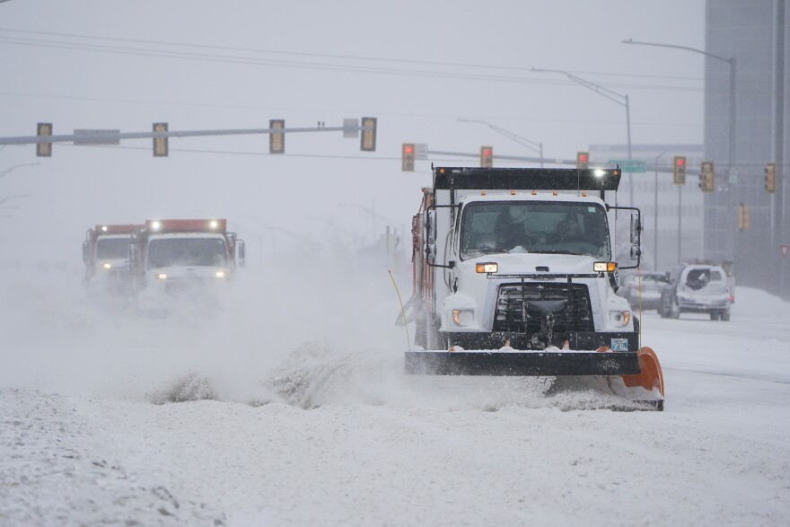
- Wednesday, February 12: The worst of the storm arrives. Freezing rain, sleet, and snow will make roads extremely dangerous. Power outages are possible due to ice accumulation on power lines and trees. Highs will barely reach 30°F (-1°C), with lows dropping to 10°F (-12°C).
- Thursday, February 13: The storm starts moving out, but bitter cold remains. Morning wind chills could make it feel like -5°F (-20°C). Highs will struggle to reach 31°F (0°C), and any moisture left on roads will freeze solid overnight.
- Friday, February 14: A slight warm-up begins, with sun peeking through the clouds and highs reaching the upper 40s°F (9°C).
- Saturday, February 15: A milder but still chilly day with highs around 50°F (10°C). Roads should improve, but black ice could still be a problem in the mornings.
What’s the Biggest Concern?
The worst part of this storm will be the ice accumulation. Freezing rain is expected to coat roads, trees, and power lines, leading to:
- Extremely dangerous driving conditions – even a thin layer of ice can make roads impassable.
- Power outages – ice buildup could snap tree limbs and bring down power lines.
- Risk of injury from falls – sidewalks and driveways will be slick and hazardous.
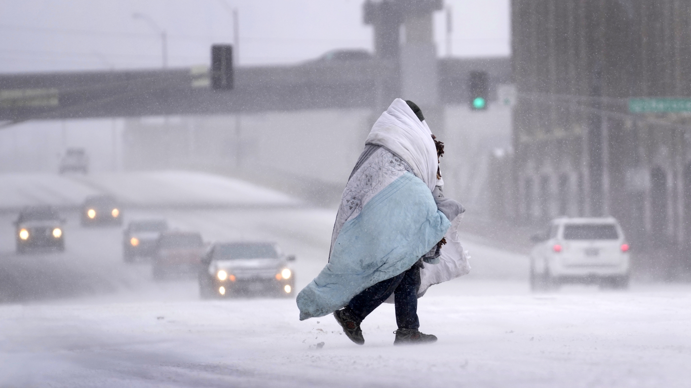
- Life-threatening cold – wind chills will drop to dangerous levels, increasing the risk of frostbite and hypothermia.
How to Stay Safe During This Storm
With freezing rain and arctic air moving in, here’s what you should do now:
- Avoid travel if possible. If you must drive, go slow, allow extra space, and be prepared for sudden icy patches.
- Stock up on supplies. Have food, water, flashlights, and blankets ready in case of power outages.
- Prepare for extreme cold. If you have to be outside, wear multiple layers, gloves, and a hat.
- Check on neighbors and pets. Make sure elderly neighbors are safe and bring pets indoors.
- Watch for black ice. Even after the storm clears, roads and sidewalks will stay dangerously slick.
This is a Serious Storm
Oklahoma is facing a dangerous mix of freezing rain, snow, and bitter cold that will impact travel and daily life. Icy roads, power outages, and extreme cold are real threats. Stay informed, take precautions, and most importantly, stay safe. This storm will test Oklahoma’s winter preparedness – make sure you’re ready!