
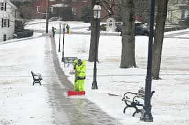
Winter isn’t going anywhere anytime soon, and this week, Connecticut residents are in for a tough stretch of snow, freezing rain, and frigid temperatures. With several winter storms expected to sweep through the state, officials are urging residents to prepare for hazardous driving conditions, possible power outages, and disruptions to daily life. The National Weather Service has already issued warnings, and experts say the combination of snow and ice will make roads treacherous and outdoor activities risky. Whether you’re heading to work or just running errands, you’ll want to bundle up and plan.
Monday: Cold Morning with Icy Roads
Monday starts deceptively calm, with partly sunny skies during the day. But don’t be fooled by the sun—it’ll be cold. Morning temperatures will hover around 35°F (2°C) before dropping to a frigid 9°F (-13°C) at night. Leftover ice from earlier weather systems could create slippery spots on sidewalks and roads, so commuters should drive slowly and watch for black ice during the morning rush.
Tuesday: Cloudy and Freezing
Tuesday will be cloudy and chilly, with daytime highs peaking at 33°F (0°C). While no major snowfall is expected, the cold will keep any existing snow and ice firmly in place. Roads and sidewalks may remain slick, so if you’re heading out, give yourself extra time and be cautious on turns or hills.
Wednesday: Light Snow and Freezing Temperatures
A few morning flurries are expected on Wednesday, but nothing major in terms of accumulation. The high will hover around 33°F (1°C) before dipping to 27°F (-3°C) overnight. Even though the snow will be light, don’t underestimate its impact. Slick roads and reduced visibility could cause delays, so take it slow on your morning commute.
Thursday: Ice in the Morning, Some Sun Later
Thursday will be tricky. Morning temperatures will be cold enough to freeze any moisture left on the ground, creating patches of ice. But as the day progresses, temperatures will warm up to around 42°F (5°C), offering a brief break before dropping back down to 23°F (-5°C) at night. The thaw-freeze cycle could make evening commutes hazardous, so be careful, especially on bridges and overpasses.
Friday and Saturday: Bitter Cold and More Snow
Friday will bring sunshine, but don’t let it fool you—it’s going to be freezing. The high will only reach 32°F (0°C), and temperatures will plunge to 9°F (-13°C) overnight. If you’re planning any Valentine’s Day outings, dress warmly. Saturday brings considerable cloud cover and afternoon snow, which could accumulate quickly. Make sure you have your shovel and snow boots ready.
How to Stay Safe During This Cold Snap
- Drive Carefully: Snow and ice could make roads slick, so reduce your speed and leave extra space between vehicles.
- Layer Up: With temperatures dipping into the single digits at night, frostbite and hypothermia are real risks. Wear hats, gloves, and multiple layers when heading outside.
- Stock Up on Essentials: Have food, water, and medications on hand in case conditions keep you home.
- Check on Neighbors: Elderly or vulnerable individuals may need help staying warm or accessing supplies.
This week’s weather is no joke, and Connecticut residents are being urged to take the forecast seriously. If you’re well-prepared, you can ride out this winter blast safely. Stay warm, stay safe, and keep an eye on local updates!