
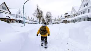
A powerful lake-effect snowstorm is set to hit regions downwind of the Great Lakes, bringing intense snowfall, strong winds, and dangerous travel conditions. According to the National Weather Service (NWS), areas in Michigan, Ohio, Pennsylvania, and New York are bracing for severe winter weather, with some locations expected to receive over a foot of snow.
Winter storm warnings and advisories have been issued as meteorologists warn of whiteout conditions, road closures, and hazardous commutes across multiple states.
Cities and Regions Most Affected
Michigan
Northern Michigan is already under winter storm warnings and advisories, with some areas expected to receive up to 5 inches of snow by Thursday morning. The Lower Peninsula, including cities like Manistee and Benzie County, is experiencing rapid snowfall accumulation, making roads treacherous.
Western New York
The Buffalo, Rochester, and Syracuse areas are in for a major snow event.
- Buffalo: Could see an additional 3 to 6 inches of snow on Saturday, with flurries continuing into Sunday.
- Rochester: Expected to receive 6 to 12 inches of snow, with intermittent snowfall throughout the weekend.
- Syracuse: Under a Lake-Effect Snow Warning from Thursday evening to early Saturday, with snow accumulations between 5 and 11 inches, and localized totals exceeding a foot in some areas.
Northeast Ohio & Northwest Pennsylvania
Cities like Cleveland and Erie are also in the path of the storm.
- Cleveland: Snow and rain mix expected, with 2 to 4 inches of snow before turning to rain later in the day.
- Erie: Will see morning snow showers with 2 to 4 inches of accumulation, followed by rain in the afternoon.
Travel Disruptions and Safety Warnings
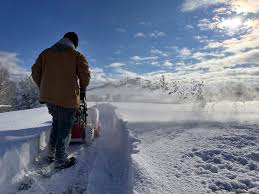
The National Weather Service is warning travellers to avoid unnecessary trips, as the storm could create dangerous whiteout conditions and poor visibility on major roadways.
- Icy roads and blowing snow will make driving hazardous.
- Visibility may drop below a mile in some areas, increasing the risk of accidents.
- Power outages are possible due to heavy, wet snow weighing down power lines.
How to Stay Safe During the Storm
✔️ Avoid travel if possible – Road conditions will be extremely dangerous.
✔️ Prepare for power outages – Have flashlights, extra batteries, and non-perishable food ready.
✔️ Keep warm and check on neighbours – Extreme cold and wind chills could make conditions worse.
✔️ Stay updated – Monitor weather alerts and local forecasts for real-time updates.
What’s Next?
Forecasters are closely tracking the storm, and additional warnings or advisories may be issued as conditions evolve. Snowfall rates may increase unexpectedly, leading to even more significant accumulations in some locations.
For the latest weather alerts, road closures, and emergency updates, check the National Weather Service website or tune into local news stations. If you’re in the affected areas, stay indoors, stay warm, and prepare for a wintery weekend ahead.