
California is gearing up for a major storm system this weekend, and it’s bringing a dangerous mix of torrential rain, powerful winds, and the looming threat of flooding and mudslides. From Southern California to the Bay Area and beyond, residents should be prepared for rapidly changing conditions that could make travel hazardous and cause serious damage in some areas.
Friday, February 14 – A Storm Moves In
The weather will start relatively mild, but don’t let that fool you—this is the calm before the storm. By Friday morning, rain will begin sweeping across the state, with Los Angeles, San Francisco, San Diego, and Sacramento all seeing steady showers throughout the day.
Los Angeles will reach a high of 64°F (18°C), but clouds will dominate the sky. San Francisco will see breezy conditions with a high of 57°F (14°C), while San Diego will experience scattered showers and a high of 62°F (17°C). Central California, including Fresno and Sacramento, will also get wet, with temperatures hovering in the low 60s°F (16°C).
While Friday’s rain may not seem extreme, it’s just the beginning. The real danger comes Saturday, when heavier precipitation arrives, increasing the risk of flooding, landslides, and road closures.
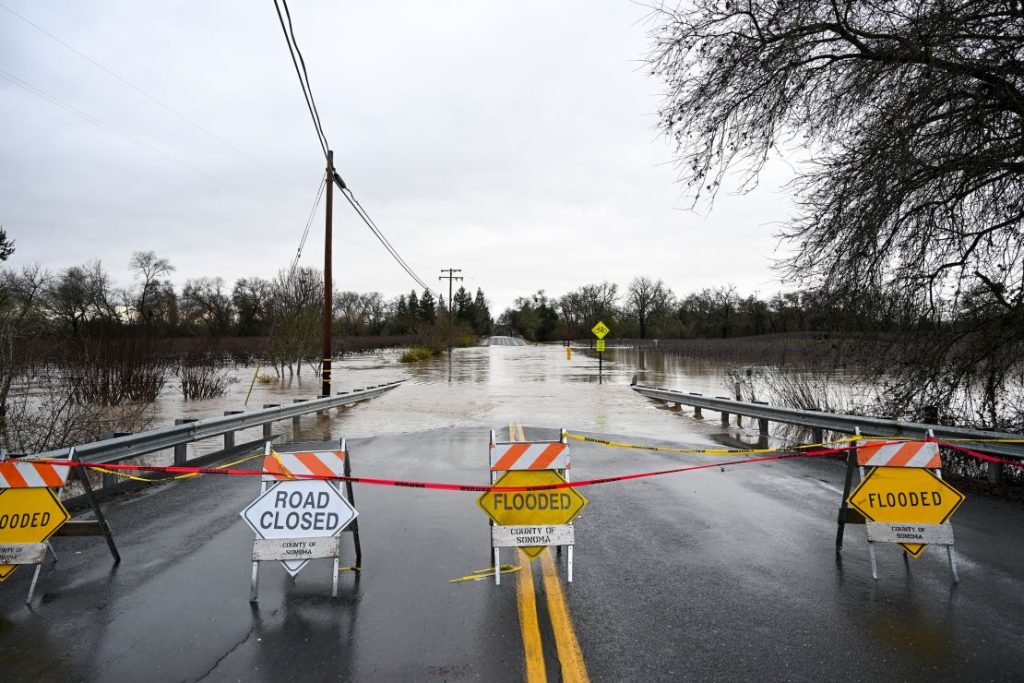
Saturday, February 15 – Torrential Rain and Mudslide Threats
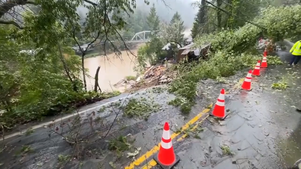
By Saturday morning, the storm had strengthened significantly, bringing heavy downpours across the state. Areas prone to flooding and burn scars from recent wildfires will be at the highest risk for dangerous mudslides and debris flows. Los Angeles could see over 1-2 inches of rain, while the Bay Area and Central California may get even more. In places where hillsides are already weak from past storms, mudslides could send debris crashing down onto roads and homes. Travelers should expect dangerous driving conditions, particularly in mountain passes where rain could mix with snow at higher elevations. Winds will also pick up, making it feel colder than the actual temperature and creating dangerous crosswinds on highways.
Sunday, February 16 – A Slight Break, but More Rain Possible
Sunday will bring a brief period of relief, with scattered showers replacing the heavy downpours. However, this doesn’t mean the dangers are over. Floodwaters will still be receding, and roads may remain closed in some areas. In Southern California, Los Angeles will see partial clearing, with a high of 72°F (22°C). San Diego will also warm up slightly to 69°F (20°C). Northern California will remain cooler, with clouds and a high of 57°F (14°C) in San Francisco. Even as the skies clear, unstable ground could lead to unexpected landslides and road collapses. Officials urge residents in flood-prone and hillside areas to remain vigilant.
How to Stay Safe During This Major Storm
- Avoid Flooded Roads: Even shallow water can sweep away a car. If you see water on the road, turn around—don’t risk it.
- Prepare for Power Outages: Strong winds and heavy rain could knock down trees and power lines, so keep flashlights, batteries, and emergency supplies handy.
- Stay Alert for Mudslides: If you live near a hillside, watch for signs of movement, such as cracking ground or trees tilting.
- Secure Outdoor Items: Strong winds could knock over patio furniture, garbage bins, and loose objects—secure them before the storm hits.
California, this is not just another rainy weekend—this storm could be a real threat to life and property. Stay informed, be prepared, and take every precaution necessary to keep yourself and your family safe.