
Boston is about to be hit with one of the most extreme winter weather events of the season, as a powerful polar vortex sends temperatures plummeting and a massive snowstorm threatens to bury the city. The National Weather Service has issued winter storm warnings and wind chill advisories, urging residents to prepare for what could be a dangerous combination of life-threatening cold and heavy snowfall.
This Week’s Forecast
Temperatures will take a dramatic plunge starting Monday, with highs struggling to reach 29°F (-2°C) and overnight lows dipping to a bone-chilling 13°F (-11°C). By Tuesday, conditions will worsen as temperatures drop even further, with lows around 10°F (-12°C) and brutal wind chills making it feel as cold as -10°F (-23°C). Forecasters warn that strong winds reaching 50 mph (80 kph) will make it feel even colder, increasing the risk of frostbite and hypothermia for anyone exposed to the elements for too long. At these temperatures, frostbite can occur in less than 15 minutes on unprotected skin, and staying outside for extended periods could become life-threatening.
Major Snowstorm Set to Dump a Foot of Snow
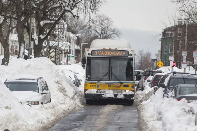
As the Arctic air settles over New England, a powerful winter storm is set to arrive late Wednesday into Thursday, bringing significant snowfall, icy roads, and travel chaos. Snowfall predictions range from 8 to 12 inches (20 to 30 cm), but some areas could see even more depending on how the storm strengthens. Boston residents should prepare for blizzard-like conditions, near-zero visibility, and dangerously slick roads. Travel will likely become nearly impossible during the height of the storm, and public transportation delays or cancellations are expected. Airports, including Logan International, could see widespread flight disruptions.
How This Storm Could Disrupt Daily Life
With strong winds, heavy snow, and bitter cold all hitting at once, the impacts could be severe:
- Power Outages Possible: High winds and heavy snow could bring down power lines, leaving thousands in the dark. Have flashlights, extra batteries, and warm blankets ready.
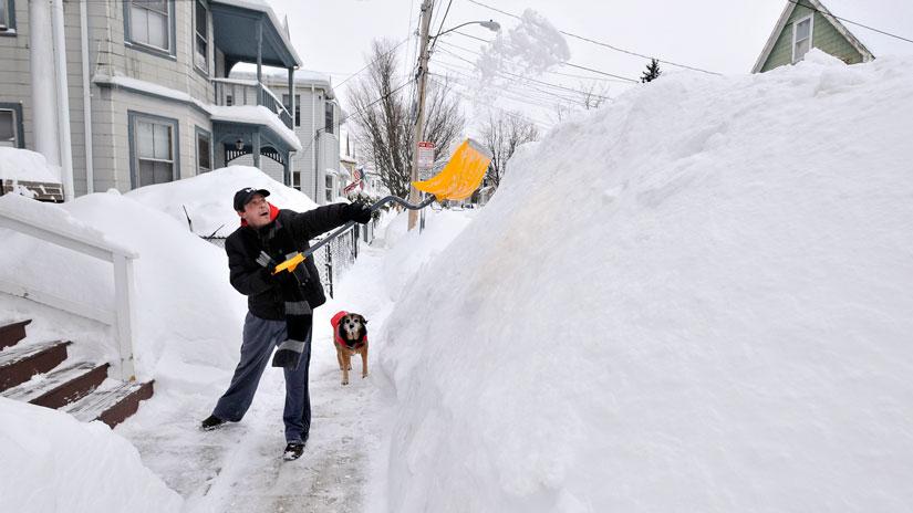
- Roads Will Be Dangerous: Black ice and deep snow will make driving treacherous. If you don’t have to travel, stay home and avoid the roads.
- Schools and Businesses May Close: Many schools and workplaces are already considering closures and remote work options as the storm approaches.
- Grocery Stores Could Be Emptied: Last-minute panic shopping may leave store shelves bare, so it’s best to stock up now on food, water, and essentials.
How to Stay Safe in This Extreme Cold and Snow
- Limit Outdoor Exposure – The combination of subzero wind chills and blowing snow could make even short trips outside extremely dangerous.
- Dress in Layers – Cover all exposed skin and wear insulated clothing, gloves, and face coverings.
- Prepare for Possible Power Outages – Charge your devices and keep emergency supplies on hand.
- Stay Off the Roads – If you must drive, carry a winter survival kit, including blankets, food, and water.
Bottom Line
Boston has seen its fair share of winter storms, but this one could be among the most intense of the season. The combination of freezing temperatures, high winds, and significant snow accumulation will make conditions extremely dangerous. If you haven’t already prepared, now is the time to gather supplies and plan for potential disruptions. Stay informed, stay warm, and most importantly, stay indoors if you can. Boston is about to be hit hard, and only those fully prepared will get through this storm safely.