
Cleveland residents, get ready for a week of dramatic weather swings as the forecast calls for bone-chilling cold, snow flurries, and an unexpected warm-up in the coming days. The National Weather Service (NWS) has issued a heads-up, warning that the city’s weather will shift rapidly from freezing conditions to milder temperatures, before bringing rain back into the mix. If you thought winter was settling in, think again—Cleveland is about to experience one of the most unpredictable weeks of the season.
Frigid Start to the Weekend with Snow in the Air
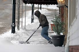
The deep freeze continues Friday morning, with temperatures plunging to 22°F (-6°C). A few light snow flurries are expected, but no significant accumulation is predicted. However, the wind chill will make it feel even colder, so residents heading out in the morning should bundle up with extra layers. By the afternoon, temperatures will struggle to reach 25°F (-4°C), making it one of the coldest days of the week. As night falls, expect lows around 19°F (-7°C), so don’t forget to drip faucets to prevent freezing pipes and keep pets indoors.
Gradual Warm-Up Through the Weekend
Saturday will bring a welcome but slow warm-up, with highs reaching 35°F (2°C) under mostly sunny skies. The winds will be breezy, making it feel colder than the thermometer suggests, but at least the sunshine will offer some relief. By Sunday, temperatures will climb even higher to 37°F (3°C), with clouds rolling in. Overnight lows will also edge above freezing for the first time in days, settling at 33°F (0°C).

Milder Temperatures Bring Rain Early Next Week
The real temperature shift happens on Monday, when highs jump to 43°F (6°C). However, with the warmer air come cloudy and breezy conditions. Rain showers are expected Tuesday into Wednesday, with temperatures remaining steady in the low-to-mid 40s. While this warm-up will feel like a break from winter’s grip, it also means melting snow and increased moisture, creating slick road conditions. Residents should be cautious of foggy mornings and icy patches as the snow melts and refreezes overnight.
What This Means for You
With such dramatic temperature swings, Cleveland residents should be prepared for everything—cold, snow, and rain. Here’s how to stay ahead of the changing conditions:
- Dress in Layers: Mornings will be bitterly cold, but by midweek, a light jacket might be all you need.
- Watch for Black Ice: Melted snow can refreeze overnight, making morning commutes dangerous. Drive carefully and avoid sudden stops.
- Prepare for Rain: Keep an umbrella and waterproof shoes handy as precipitation returns by midweek.
- Check on Elderly Neighbors: Sudden cold snaps can be dangerous for seniors and those with health conditions.
Will Winter Return?
While next week’s warm-up may feel like spring is near, don’t be fooled—another cold blast could be on the horizon before March. Keep an eye on weather updates and be ready for more surprises from Cleveland’s unpredictable winter!