
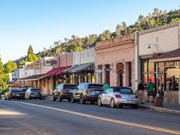
Sierra County residents, get ready for a weekend of weather that feels more like early spring than late winter! A combination of unseasonably warm temperatures and scattered rain showers will make for an unusual mix, bringing a bit of everything over the next few days. If you’ve been waiting for a break from the cold, you’re in luck, temperatures will rise well above average, making this one of the warmest February weekends in recent memory. As winter typically holds a firm grip on the Sierra region this time of year, a warm spell like this is rare. However, don’t expect a completely dry weekend. While sunshine will dominate much of the forecast, Sunday will bring a chance of rain and drizzle, making for a mild yet damp day.
How Warm Will It Get? Expect a Taste of Spring
As of Friday, February 21, 2025, temperatures have already begun creeping higher, reaching a mild 54°F (12°C) under partly cloudy skies. The evening will cool off to 40°F (4°C), making for a crisp but comfortable night.
By Saturday, February 22, the county will experience a significant warm-up. Temperatures will rise to 59°F (15°C), making it an excellent day for hiking, outdoor work, or simply enjoying the fresh air. Skies will feature a mix of clouds and sun, but overall, conditions will remain pleasant. Morning temperatures will start at 42°F (6°C), so layering up will be key for those heading out early.
Sunday, however, takes a turn. While it won’t be a complete washout, expect rain and drizzle in the morning, followed by mostly cloudy skies throughout the day. Highs will still be relatively mild at 53°F (12°C), but the dampness may make it feel cooler. Those planning to be outdoors should prepare for slick roads and trails. The morning low will hover around 44°F (6°C), so be sure to have an umbrella or rain jacket handy.

What’s Next? Will the Warmth Stick Around?
Moving into the new week, Monday, February 24, will bring another round of mild temperatures, with highs reaching 57°F (14°C) under mostly cloudy skies. No major storms are expected, but lingering clouds may keep things feeling cooler than the numbers suggest. By Tuesday, February 25, the sun will finally break through again. Temperatures will rise to 62°F (17°C), making it one of the nicest days of the week. If you’ve been waiting for a true taste of spring, this could be the day to get outside. The warm-up continues into Wednesday, February 26, where temperatures will peak at a shocking 69°F (21°C), a rare sight for February in the Sierra region. If you’re looking for a perfect midweek outing, this will be the time to take advantage of the sunshine. By Thursday, February 27, a slight cool-down begins, with highs dipping to 61°F (16°C) under partly cloudy skies.
How to Prepare for This Unusual Weather Shift
- Dress in Layers: Mornings will still be cool, but afternoons will feel like spring. Bring an extra layer for comfort.
- Be Prepared for Rain: Sunday’s showers may be light, but wet conditions could lead to slick roads and trails. Keep rain gear handy.
- Enjoy the Sunshine While It Lasts: Next week’s warm stretch is unusual for February, making it the perfect time to get outdoors.
This unexpected warm spell combined with rain proves that Sierra County’s winter isn’t ready to leave just yet. With temperatures soaring and showers lingering, it’s shaping up to be a weekend of contrasts—one that reminds us just how unpredictable the weather can be. Whether you’re heading outside to soak up the sun or staying in to avoid the drizzle, be sure to stay updated as conditions evolve!