
A powerful winter storm is taking aim at Washington’s Cascade Mountains, and it’s bringing serious snowfall. The National Weather Service has issued a Winter Storm Warning through Tuesday, with some areas expecting up to 2 feet of snow at higher elevations.
What to Expect
- Timing: The storm kicks into high gear Monday morning and will keep dumping snow through Tuesday afternoon.
- Snowfall Totals: Areas above 4,000 feet, including Stevens Pass, Snoqualmie Pass, and White Pass, could see 12 to 24 inches of snow. Lower elevations will still get a healthy dose.
- Wind Gusts: Strong winds up to 60 mph could make conditions even more dangerous, leading to whiteouts and possible power outages.
How This Will Impact You
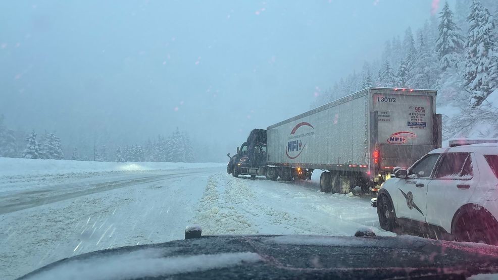
- Roads Will Be a Mess: Heavy snow and gusty winds mean treacherous driving conditions. Visibility will be low, and snow-covered roads could cause major delays. If you don’t have to travel, stay put.
- Possible Power Outages: Wet, heavy snow combined with high winds could bring down tree branches and knock out power. Be ready with flashlights, blankets, and backup heat sources.

What You Should Do
- If You Must Travel: Make sure your car is winter-ready with chains, extra blankets, food, and water. Let someone know your route.
- Stay Prepared at Home: Stock up on essentials in case of power outages. Charge your devices, and have extra batteries on hand.
- Stay Updated: Weather conditions can change quickly. Keep an eye on local forecasts and check road conditions before heading out.
This storm is part of a bigger system bringing a surge of Pacific moisture into the region. While it’ll be great news for ski resorts, it’s bad news for anyone traveling through the mountains.
If you can, stay home and stay safe. If you have to be on the road, be prepared for winter’s full force.