
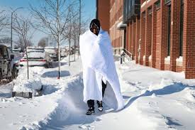
South Dakotans, get ready for a week of dramatic weather swings! Monday will bring a much-needed warm-up, but don’t be fooled—freezing nighttime temperatures could turn roads into ice rinks and create some unexpected hazards.
A Taste of Spring… for a Few Hours
After weeks of winter chill, Monday will feel like a breath of fresh air. Most of the state will see highs in the 50s, with Rapid City possibly seeing low 60s. Sioux Falls might even flirt with breaking the record, with temperatures as high as 62°F, which hasn’t been recorded on this date since 1896!
But before you pack away the winter coat, here’s the catch…
Freezing Nights = Icy Trouble
Once the sun sets, temperatures will drop fast. Overnight lows will plunge back below freezing, hitting the mid to upper 20s in some areas. That means all the snowmelt from the daytime warmth? It’s going to refreeze overnight, leading to black ice on roads, sidewalks, and driveways.

What You Need to Know
- Morning Ice Danger: Be extra careful when heading out early—what looks like a wet road could actually be a slick sheet of ice.
- Bridge & Overpass Trouble: These spots freeze faster than regular roads, so expect slippery conditions in the mornings and late evenings.
- Burst Pipe Alert: The freeze-thaw cycle puts pressure on pipes. If you haven’t already, consider insulating exposed pipes to prevent costly damage.
- Watch Your Step: Sidewalks and driveways could be dangerously slick—salt them before bed to avoid an early-morning slip.
Bottom Line
Enjoy the sunshine while you can, but don’t underestimate the freezing nights ahead. This back-and-forth weather pattern is a classic winter trap, and South Dakota drivers and homeowners should stay prepared. Take it slow on the roads, bundle up after sunset, and keep an eye on those icy patches!