
Wisconsin is getting a taste of spring this week, but don’t get too comfortable—it won’t last long. Warmer temperatures are moving in, but rain chances are creeping up as we head into next week. Here’s what you need to know.
A Warm but Windy End to the Week
Starting Friday, temperatures will climb well above normal, with places like Madison reaching the mid-50s. That’s nearly 20 degrees warmer than usual for this time of year! But don’t let the warmth fool you—gusty winds and dry air will create an elevated fire risk. If you’re planning any outdoor burning, think twice.
Cold Front Crashes the Party
Enjoy the warmth while you can because by Saturday, winter makes a quick comeback. A cold front will push through, dropping highs back into the 20s and 30s across the state. Green Bay, for example, could see temperatures plunge nearly 30 degrees in just 24 hours. If you’re heading out, layer up—it’s going to feel like winter all over again.

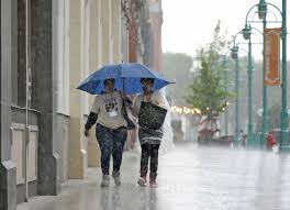
Rain Moves in Next Week
Starting Monday, the clouds roll in, and rain chances increase. Expect scattered showers through Tuesday, with temps hovering in the 40s. While it won’t be a washout, roads could get slick, so drive with caution.
What to Watch For:
Warm & Windy Friday: High fire danger—avoid burning.
Cold Snap Saturday: Temps drop fast, so keep that winter coat handy.
Rain Returns Monday-Tuesday: Wet roads could make for tricky commutes.
Wisconsin’s weather is keeping us on our toes—so enjoy the warmth while it lasts, but don’t pack away the winter gear just yet!