
Sacramento is bracing for a dramatic shift in weather starting Friday, as two significant storm systems roll through the region bringing widespread rain, mountain snow, and gusty southerly winds. With flooding concerns, travel delays, and dangerous driving conditions expected, officials urge residents to stay prepared and cautious. The first storm will hit from Friday through Sunday, bringing rain to the valleys and snow to higher elevations. A second, stronger system is set to arrive early next week, with heavier precipitation and more impactful snowfall.

Storm One: Weekend Rain and High-Elevation Snow
The first storm is a warm system that will deliver steady rainfall across much of Northern California. Mountain regions above 6,000 feet are expected to receive 1–3 inches of snow, but the snow level will likely stay above major passes, limiting severe travel disruptions. However, nuisance flooding from the rain may cause minor travel issues, particularly in low-lying areas.
Chain controls are already in place along parts of I-80, and drivers heading into the Sierra are advised to check highway conditions before traveling. Southerly winds will add to the storm’s impacts, with gusts of up to 35 mph expected Saturday and again on Monday, especially in exposed regions.
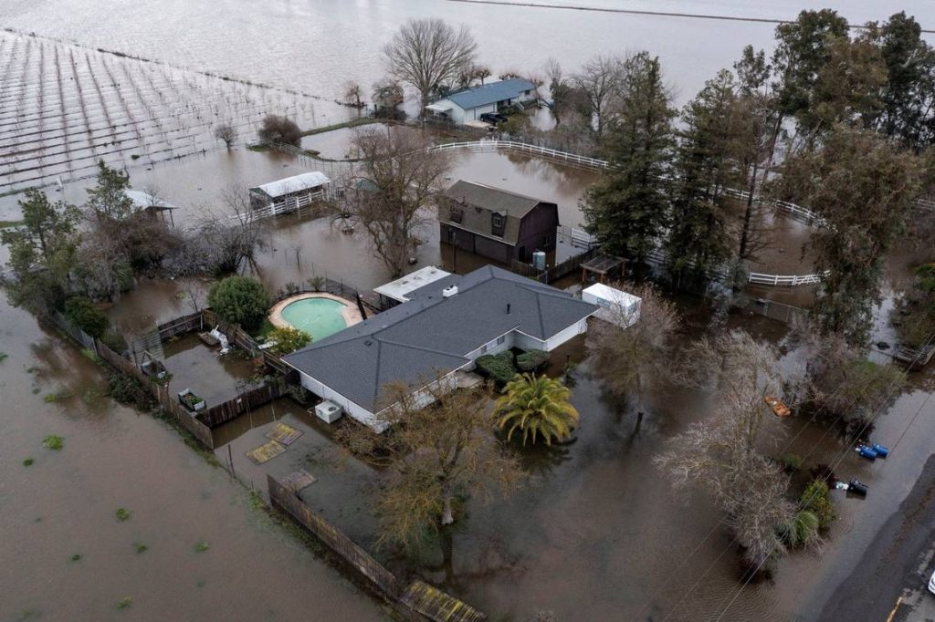
This storm marks the first measurable rainfall for the area since January 3, breaking a dry spell that had left the region parched. A flood watch is in effect until 10 p.m. Sunday for Sacramento, San Joaquin, Solano, and Stanislaus counties, while a winter weather advisory remains active in the Sierra until 4 a.m. Sunday.
Storm Two: Colder, More Intense Snowstorm Early Next Week
The second storm, arriving late Monday and lasting through Wednesday, is expected to pack a colder punch. Rainfall totals in the Sacramento Valley could reach 1-2 inches, while the foothills and mountain regions could see 2–4 inches of rain, with some localized areas getting up to 7 inches.
This storm will deliver significant snow accumulations at lower elevations. Areas above 5,000 feet could receive 6–18 inches of snow, with higher elevations exceeding two feet. Unlike the weekend system, this storm could create more hazardous mountain travel, impacting commutes and requiring chain controls across multiple highways.
Forecast models suggest possible timing and precipitation adjustments, so residents should stay tuned to updated weather alerts. No river flooding is anticipated, though rivers, streams, and creeks will rise sharply.
State Response and Preparations
Gov. Gavin Newsom has pre-deployed state resources, including emergency crews and equipment, to protect communities from flooding, debris flows, and travel issues. Special attention is being paid to areas with recent burn scars, which are prone to mudslides and landslides during heavy rainfall. “The best thing people can do now is prepare and stay alert,” Newsom advised.

January in Review
Despite a dry January so far, this double storm threat is expected to boost precipitation totals significantly. As California’s snow survey kicks off on Friday, these storms could give the region’s water resources