
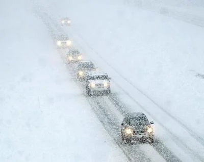
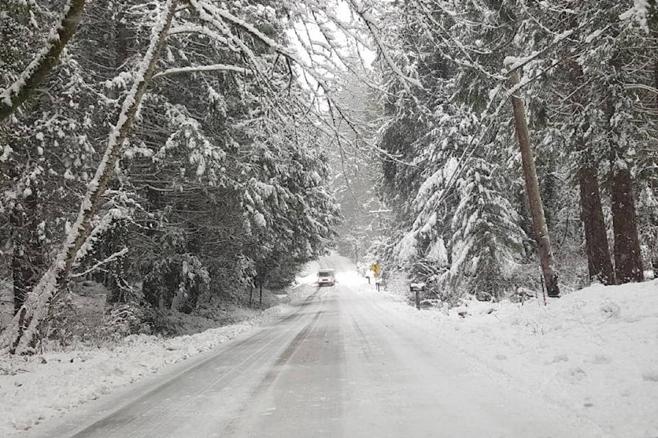
Idaho is in for a rough weekend as a powerful winter storm moves in, bringing heavy snow, fierce winds, and dangerously low temperatures that will impact travel and daily life. Forecasters are warning that conditions could turn treacherous, with significant snowfall in some areas, strong winds creating whiteout conditions, and temperatures plunging well below freezing.
Friday: Snow, Wind, and Tough Travel Conditions
- Boise: Cloudy skies with periods of moderate snowfall throughout the day. An additional 3-6 cm of snow is expected before tapering off to flurries. Breezy conditions in the afternoon will make it feel colder, with a high of 39°F (4°C) and a low of 20°F (-7°C).
- Idaho Falls: Snow will be heavier here, with an additional 5-10 cm of accumulation. Winds gusting up to 40 mph will create blowing and drifting snow, reducing visibility and making travel dangerous. The high will reach 38°F (3°C), dropping to 22°F (-6°C) at night.
- Pocatello: A messy mix of snow and rain will transition to all snow by evening, leading to 6-12 cm of accumulation. Winds will increase, gusting over 40 mph, making road conditions especially hazardous. Expect a high of 46°F (8°C), with a low of 23°F (-5°C).
- Coeur d’Alene: The northern part of the state will remain drier, but temperatures will still be frigid. Mostly sunny to partly cloudy skies with a high near 30°F (-1°C) and a low of 11°F (-12°C).
Saturday: Temporary Break, But Cold Sticks Around
- Boise: Partly sunny, but still cold, with a high of 36°F (2°C) and a low of 22°F (-6°C).
- Idaho Falls: A cold, blustery day with wind chills making it feel even colder. Highs will struggle to reach 27°F (-3°C), with a low of 11°F (-12°C).
- Pocatello: Cloudy and breezy with lingering flurries, a high near 33°F (0°C), and a low of 16°F (-9°C).
- Coeur d’Alene: Mostly cloudy, a few flurries possible, but otherwise dry. High of 29°F (-2°C), low of 18°F (-8°C).
Sunday: More Snow Moves In, Arctic Cold Arrives
- Boise: A fresh burst of snow could bring another 2-5 cm, with strong winds keeping wind chills dangerously low. High near 37°F (3°C), low of 20°F (-6°C).
- Idaho Falls: Temperatures plummet to a high of just 23°F (-5°C), with lows dipping to 6°F (-14°C). Snow showers will be off and on throughout the day.
- Pocatello: A little snow will develop in the afternoon, but accumulation should be minor. Highs will reach 31°F (0°C), with a low of 13°F (-11°C).
- Coeur d’Alene: Bitter cold continues, high of 29°F (-2°C), low of 9°F (-13°C).
How to Stay Safe During This Winter Storm
With dangerous travel conditions, subzero wind chills, and the potential for power outages, Idaho residents need to take precautions now to stay safe and prepared.
- Avoid unnecessary travel. Snow-covered roads and strong winds will create whiteout conditions, especially in southern Idaho. If you must drive, make sure you have an emergency kit with blankets, water, snacks, and a phone charger.
- Prepare for potential power outages. Heavy, wet snow and strong winds can knock down power lines. Have flashlights, extra batteries, and an alternative heat source ready.
- Dress in layers. Wind chills will make it feel much colder than the actual temperature. Wear insulated gloves, hats, scarves, and waterproof boots to avoid frostbite.
- Check on vulnerable individuals. The elderly, young children, and pets are especially vulnerable to extreme cold. Make sure they have a warm place to stay and enough supplies.
This upcoming winter storm will be one of the most intense Idaho has seen this season, and residents need to take it seriously. Travel will be dangerous, power outages are possible, and temperatures will drop to life-threatening levels in some areas. Get supplies now, stay off the roads if possible, and be prepared for brutal cold in the coming days. Idaho’s winter is far from over, and this storm is just a reminder of how quickly conditions can turn dangerous. Stay warm, stay safe, and stay informed—this storm is no joke!