
Maryland is about to face some serious winter weather, so if you’ve been enjoying the recent calm, it’s time to switch gears. A powerful winter storm is expected to hit the state starting Tuesday afternoon, bringing heavy snowfall, sleet, and freezing rain. The National Weather Service has issued Winter Weather Advisories, warning that travel could become difficult or even dangerous. If you have any plans for the next few days, consider changing them or preparing for delays because this storm isn’t one to take lightly. From Baltimore to rural areas further north, the impacts will be felt everywhere. Whether you’re commuting or just running errands, you’ll want to stay ahead of the storm to avoid trouble on the roads.
Tuesday, February 11: The Snow Begins
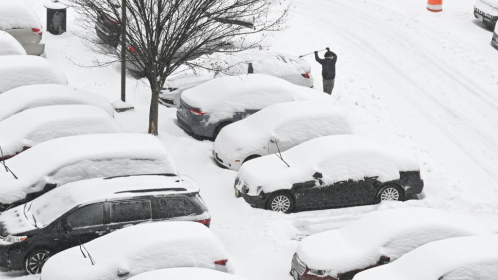
The day will start quietly with cloudy skies and cool temperatures hovering around 35°F (2°C). But by the afternoon, snowflakes will begin to fall, and they’ll keep coming as evening approaches. Forecasters expect between 2 to 5 inches of snow by the time the night is over, with the heaviest accumulation during rush hour and into the night. With temperatures dipping below freezing overnight, the snow will quickly turn slick, creating slippery roads and sidewalks. If you have to drive, leave plenty of extra time to get to your destination and be ready for stop-and-go traffic. Emergency officials are advising against unnecessary travel, so if you can stay home, that’s your best bet.
Wednesday, February 12: A Messy Morning Commute
Wednesday morning could be tricky. Expect a layer of snow and sleet on the ground, making roads icy and slow. As temperatures hover around freezing, driving conditions won’t be ideal. If you’re heading to work or school, leave early and prepare for delays. Sidewalks could also be dangerous, so wear sturdy shoes with good traction. By midday, the wintry mix will start transitioning to freezing rain and eventually regular rain as temperatures climb slightly to 36°F (2°C). But don’t let your guard down—water on top of ice can make for slippery and hazardous conditions. Low-lying areas with poor drainage could see minor flooding, so keep an eye on streets that tend to collect water.
Thursday, February 13: Melting Snow, but Watch for Ice
Thursday will be warmer, with temperatures hitting 51°F (10°C). Much of the snow and ice will melt, giving you a short break from the mess. But as night falls and temperatures drop again, any leftover water could refreeze, creating black ice on roads and sidewalks. Be cautious during evening commutes and the following morning.
Looking Ahead: Another Storm Could Hit This Weekend
Just when you think it’s over, another storm is lurking on the horizon. Weather models suggest that Saturday could bring more rain, wind, and possibly snow. Flooding is a concern, especially in areas already soaked from this week’s storm. Gusty winds could knock down trees and power lines, so be prepared for possible power outages.
How to Stay Safe During the Storm
- Avoid Driving When Possible: If you can stay off the roads, do it. Snow, ice, and freezing rain are a dangerous combination, even for experienced drivers.
- Check Your Home: Clear out gutters and drains to prevent water buildup. Have sand or salt ready to treat your driveway and walkways.
- Emergency Kit: Make sure you have flashlights, batteries, non-perishable food, water, blankets, and a first-aid kit in case of power outages.
- Stay Updated: Follow local news and weather alerts. Conditions can change quickly, and you’ll want to be ready if things take a turn for the worse.
Final Thoughts
This winter storm could create a lot of headaches, from traffic delays to icy sidewalks and flooding. But with some preparation and caution, you can stay safe and avoid major problems. Don’t wait until it’s too late—get ready now, keep an eye on weather updates, and take it slow when you’re out and about. Another storm may be coming this weekend, but for now, let’s get through this one safely, Maryland!