
A powerful winter storm is on track to hit New Jersey this weekend, bringing a dangerous mix of snow, sleet, and freezing rain that could cause major disruptions across the state. Forecasters are warning of hazardous road conditions, potential power outages, and brutally cold temperatures. The National Weather Service has issued a Winter Storm Watch for parts of the state, urging residents to prepare for a rough weekend. With snow set to begin Saturday afternoon and continue into Sunday morning, this storm is expected to bring significant travel hazards and bitterly cold temperatures once it moves out. If you have weekend plans, you’ll want to pay close attention to the latest updates.
Friday: The Calm Before the Storm
For now, the weather remains fairly quiet across New Jersey, but don’t let that fool you—big changes are coming soon.
- Newark: Partly sunny and windy, with a high of 41°F (5°C) and a low of 22°F (-6°C).
- Trenton: Mostly sunny with similar temperatures, high of 40°F (4°C), low of 23°F (-5°C).
- Atlantic City: A bit warmer, with a high of 46°F (8°C) and a low of 29°F (-2°C).
While Friday will feel relatively mild for February, don’t get too comfortable—the storm moves in on Saturday, and things will go downhill fast.
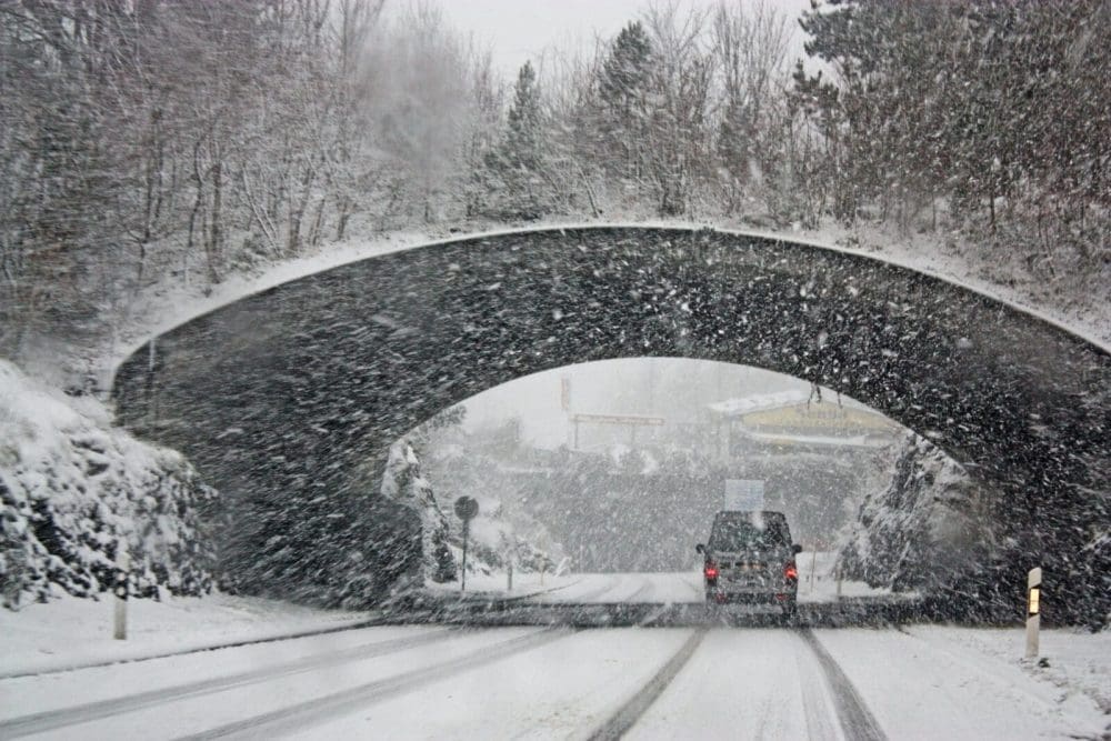
Saturday: The Storm Arrives
By Saturday afternoon, snow will start falling across much of the state, gradually turning into a wintry mix as the evening progresses. The heaviest snow and ice are expected overnight, making travel extremely dangerous.
- Newark: Increasing cloud cover with snow developing late in the day. High of 35°F (2°C), low of 29°F (-2°C).
- Trenton: Snow in the afternoon, mixing with sleet by evening. High of 34°F (1°C), low of 28°F (-2°C).
- Atlantic City: A mix of snow and sleet in the late afternoon. High of 35°F (2°C), low of 32°F (0°C).
Icy roads, low visibility, and slick conditions will make driving dangerous on Saturday night. If you don’t have to go out, stay home.
Sunday: Lingering Snow and Bitter Cold
Snow and freezing rain will continue into Sunday morning, before tapering off in the afternoon. However, bitter cold temperatures and strong winds will keep conditions dangerous.
- Newark: Snow and rain in the morning, turning breezy and cold. High of 39°F (4°C), low of 24°F (-4°C).
- Trenton: Cloudy with lingering flurries, high of 40°F (4°C), low of 25°F (-4°C).
- Atlantic City: Windy with cloudy skies, high of 42°F (6°C), low of 29°F (-2°C).
Even after the snow stops falling, freezing temperatures will cause untreated roads to remain icy and dangerous.

How to Stay Safe in This Storm
With snow, sleet, and ice in the forecast, taking precautions now can help you avoid serious problems once the storm hits.
- Avoid unnecessary travel – Roads will be hazardous, especially Saturday night into Sunday morning. If you must drive, take it slow, leave plenty of distance between cars, and carry an emergency kit in your vehicle.
- Prepare for power outages – Heavy snow and ice could bring down power lines. Have flashlights, extra batteries, and a backup heat source ready.
- Dress for the extreme cold – Wind chills will make it feel even colder than the actual temperature. Wear layers, gloves, and a hat if you have to go outside.
- Check on elderly neighbors and loved ones – The extreme cold can be dangerous for vulnerable individuals. Make sure they have heat, supplies, and a safe place to stay.
- Stay updated – This storm could shift in intensity and snowfall amounts, so keep an eye on local forecasts for the latest information.
What Comes Next?
While Sunday will mark the end of the storm, the cold air will stick around next week, keeping icy conditions in place.
- Monday: Cloudy and cold, high of 36°F (2°C), low of 22°F (-6°C).
- Tuesday: Another chance of snow, high of 34°F (1°C), low of 21°F (-6°C).
- Wednesday & Thursday: Chilly and dry, highs in the mid-30s, lows in the teens and 20s.
This storm will be one of the biggest winter events of the season for New Jersey, and residents should take it seriously. Snow, ice, and freezing temperatures will create dangerous conditions, especially for travel.
Final Thoughts
New Jersey is no stranger to winter storms, but this one has the potential to cause major problems. Hazardous roads, power outages, and bone-chilling temperatures will make for a difficult weekend. Stock up on supplies, stay indoors if possible, and keep an eye on weather alerts. Winter isn’t done with New Jersey yet, and this storm is proof of that. Stay warm, stay safe, and be prepared!